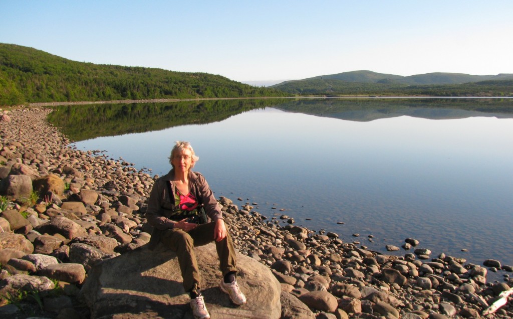
Here I’m on the shore of Trout River Pond, Gros Morne National Park (© Vilis Nams)
Three days beyond Christmas, rain and mist spill onto northern Nova Scotia, transforming snow into sodden slush. Dusk comes early beneath leaden clouds, the antithesis of the long summer evenings Vilis and I enjoyed while exploring Newfoundland in late June and early July. Gros Morne National Park on the island’s west coast had beckoned to us from afar, and we spent three and a half days hiking and climbing its spectacular landforms. This post is devoted to Day 1, during which we hiked 15 kilometres on four trails.
In the still beauty of early morning, we walked the shoreline and adjacent boreal forest of Trout River Pond (a huge lake), discovering a spotted sandpiper’s nest, blue-flag irises and other wildflowers such as yellow clintonia, false lily-of-the-valley, bunchberry, buttercup, and wild strawberry. Red squirrels chattered in the forest, loons yodelled from the water, and the music of robins, black-capped chickadees, yellow warblers, black-throated green warblers, northern waterthrushes, white-throated sparrows, and savannah sparrows filled the air with bright sound. A glistening land snail with a gloriously-striped shell slid over boulders on a trail of mucus secreted from its rubbery foot.
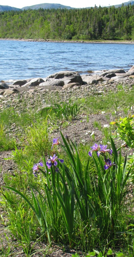
Blue-flag Irises, Trout River Pond (© Magi Nams)
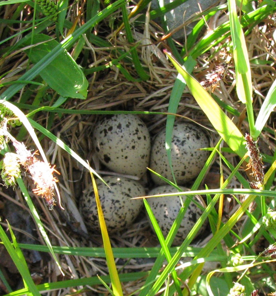
Spotted Sandpiper Nest, Trout River Pond (© Magi Nams)
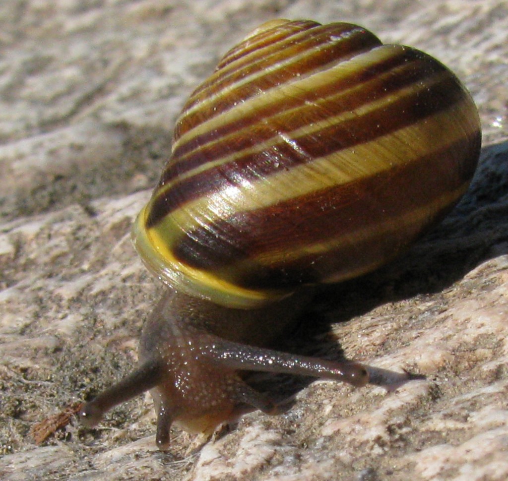
Land Snail, Trout River Pond (© Magi Nams)
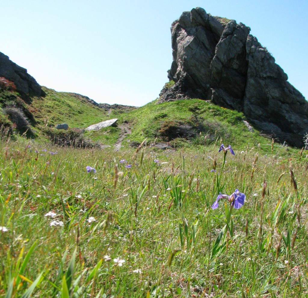
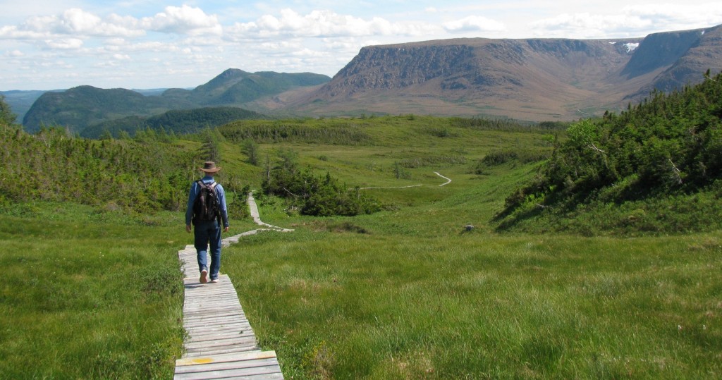
In long views, forested hills hemmed in the ‘pond,’ filling our view with vivid green and sparkling blue. After leaving Trout River Pond, we hiked Trout River’s Eastern Point Trail edged with wildflowers and thrusting rock formations. Gros Morne National Park was created long after tiny fishing villages sprang up along Newfoundland’s west coast, so pockets of private land, such as that on which the fishing village of Trout River is located, bite into the park. As a result, Eastern Point Trail isn’t in the national park, but is still well worth hiking.
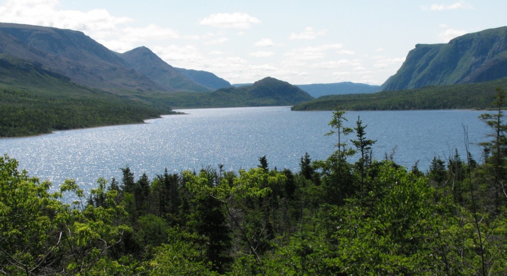
Trout River Pond, Gros Morne National Park (© Magi Nams)
Eastern Point Trail, Trout River, Newfoundland (© Magi Nams)
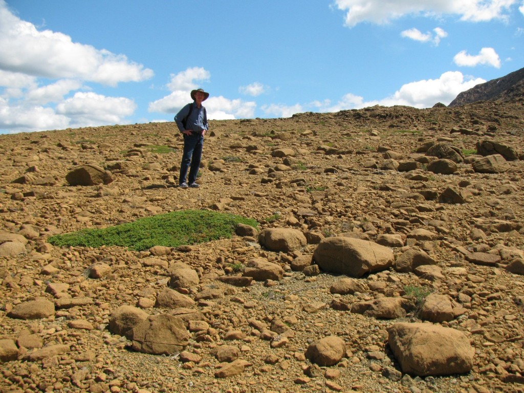
Leaving Trout River, we drove east through the park’s southwest corner to Tablelands, an orange-brown expanse of peridotite, exposed mantle rock. Tablelands is a rare example of overturned ocean floor and offers geological evidence for the theory of plate tectonics. In the heat of early afternoon, we hiked past red rock slopes and cliffs where snow lay caught in high reaches. Streams carrying snowmelt rushed over red boulders. Inhospitable to plant life, Tablelands on the south side of Highway 431 appeared barren in comparison with the boreal forest cloaking hills on the north side of the highway.

Tablelands, Gros Morne National Park (© Magi Nams)
Vilis on Tablelands, Gros Morne National Park (© Magi Nams)
Dwarf birches, junipers, alder, spruce, and stubby tamaracks edged the trail and filled rocky creases. Cottongrass and pitcher plants (Newfoundland’s provincial flower) grew in damp depressions, while chickweed, cinquefoil, bellflower, sea thrift, saxifrage, and moss campion formed green patches on open rock slopes and plains that reminded me of polar desert. “In a place like this, you don’t know if you should look for kangaroos or mountain goats,” Vilis commented.
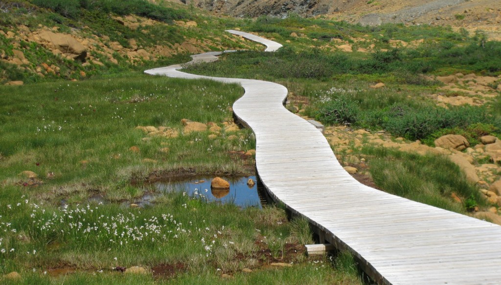
Tablelands Trail, Gros Morne National Park (© Magi Nams)
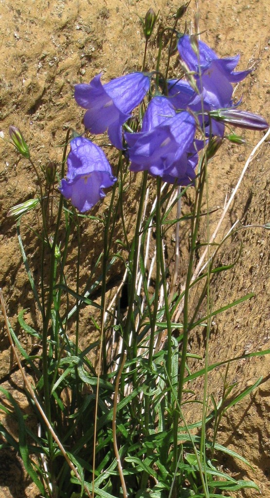
Bellflower, Tablelands, Gros Morne National Park (© Magi Nams)
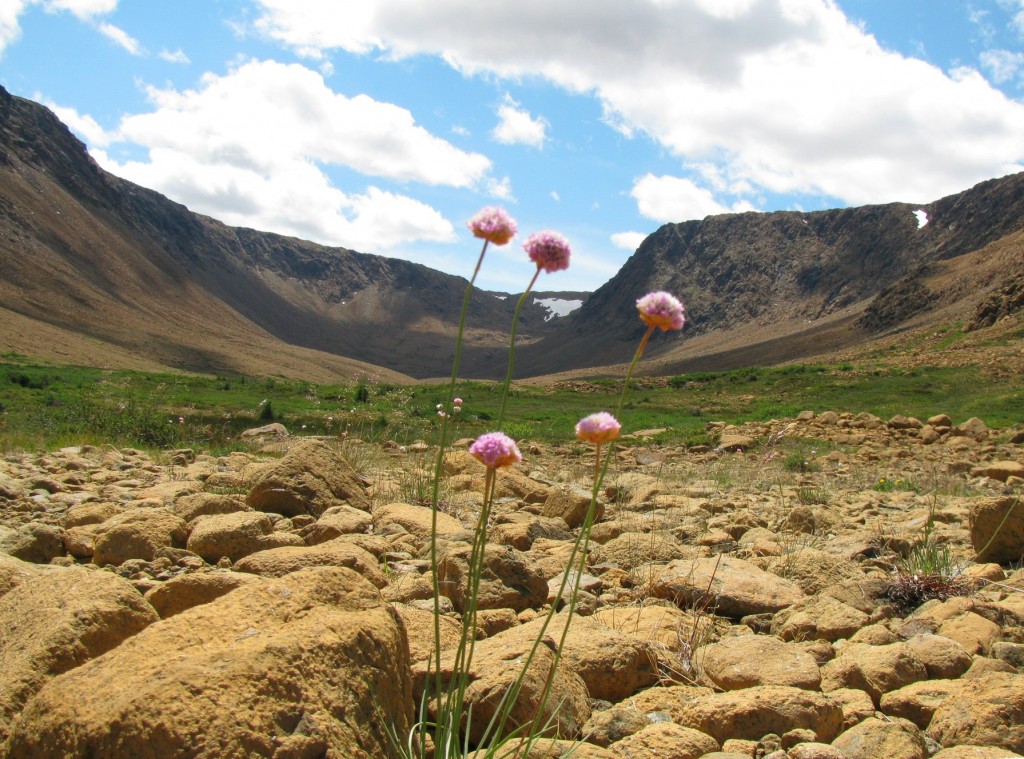
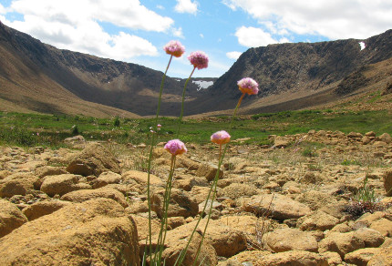
Sea Thrift, Tablelands, Gros Morne National Park (© Vilis Nams)
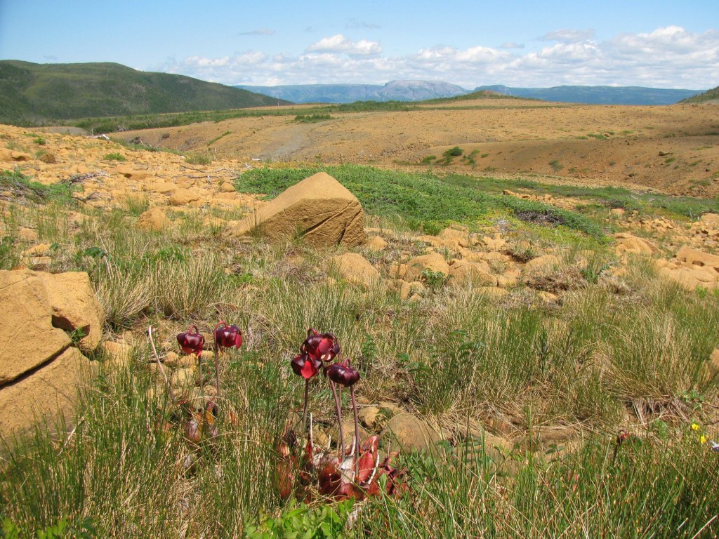
Pitcher Plants, Tablelands, Gros Morne National Park (© Magi Nams) Note Gros Morne Mountain, top centre.
Vilis descending Lookout Trail, Gros Morne National Park (© Magi Nams) Note Tablelands in upper right.
In late afternoon, we tackled our fourth hike of the day, Lookout Trail up Partridgeberry Hill. A 5-kilometre loop on steep terrain, the trail offered spectacular views of Tablelands to the southwest and of Bonne Bay, a Y-shaped, glacier-gouged fiord to the east.
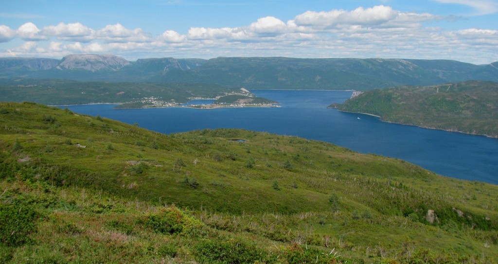
View of Bonne Bay, Norris Point, and Gros Morne Mountain from Partridgeberry Hill (© Vilis Nams)
After descending the hill, we drove east and then northwest, skirting the long fingers of Bonne Bay’s South and East Arms as well as Gros Morne Mountain’s base en route to Berry Hill campground and a welcome campfire supper and rest. Next day and next post, more fabulous hiking in Gros Morne National Park.
