
If you’re in northern Nova Scotia and looking for a challenging, forest-rich hike with scenic viewpoints, Fitzpatrick Mountain Trail fits the bill. Highly recommended.
Fitzpatrick Mountain Trail is an 11-kilometre one-way hike through a variety of woodland habitats in northern Nova Scotia. Rated moderate to difficult, the trail is open year-round and is a segment of Nova Scotia’s Cape To Cape Trail system that extends from Cape Chignecto Provincial Park on the Bay of Fundy to Cape George near Antigonish, a distance of hundreds of kilometres.
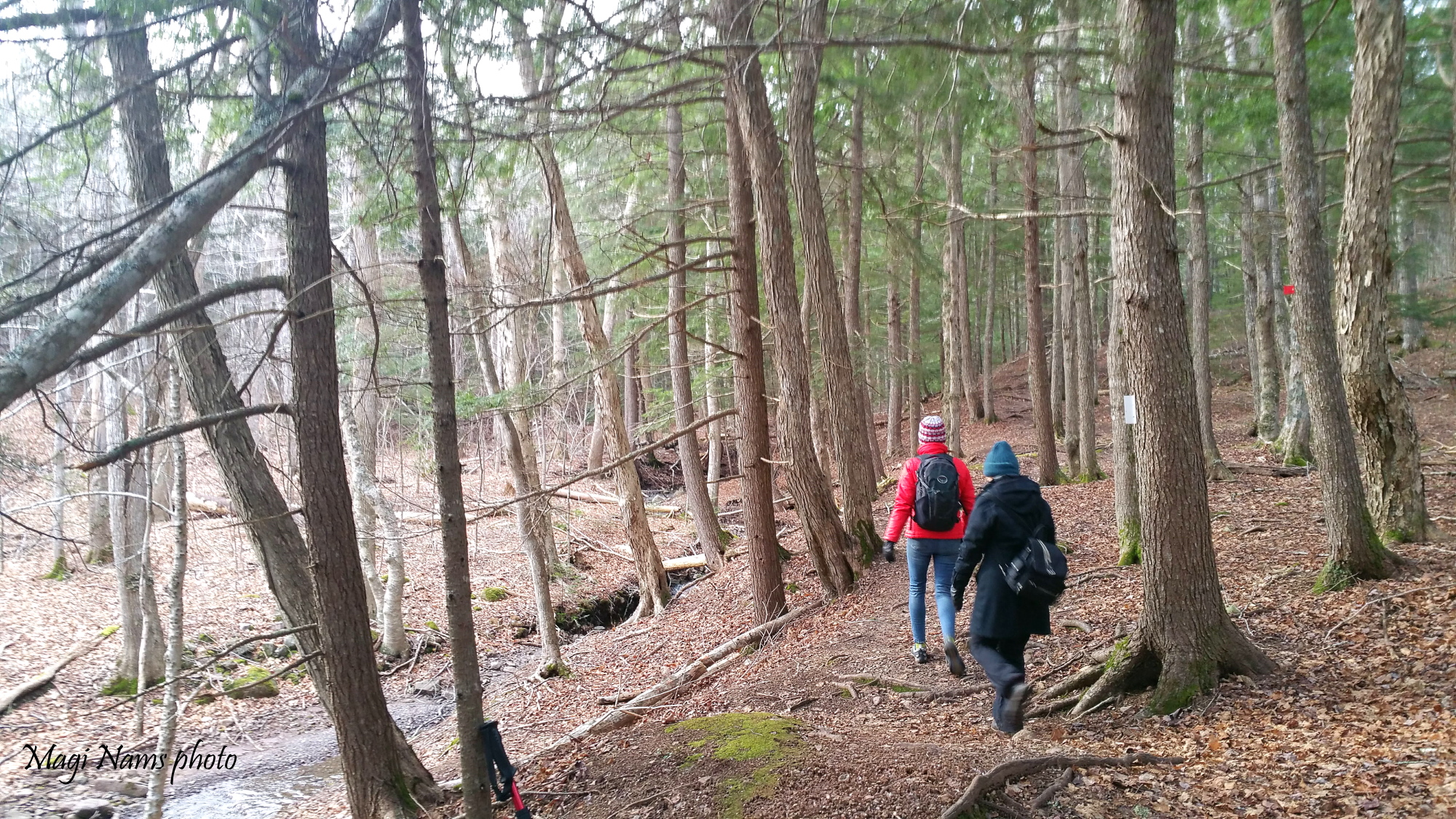
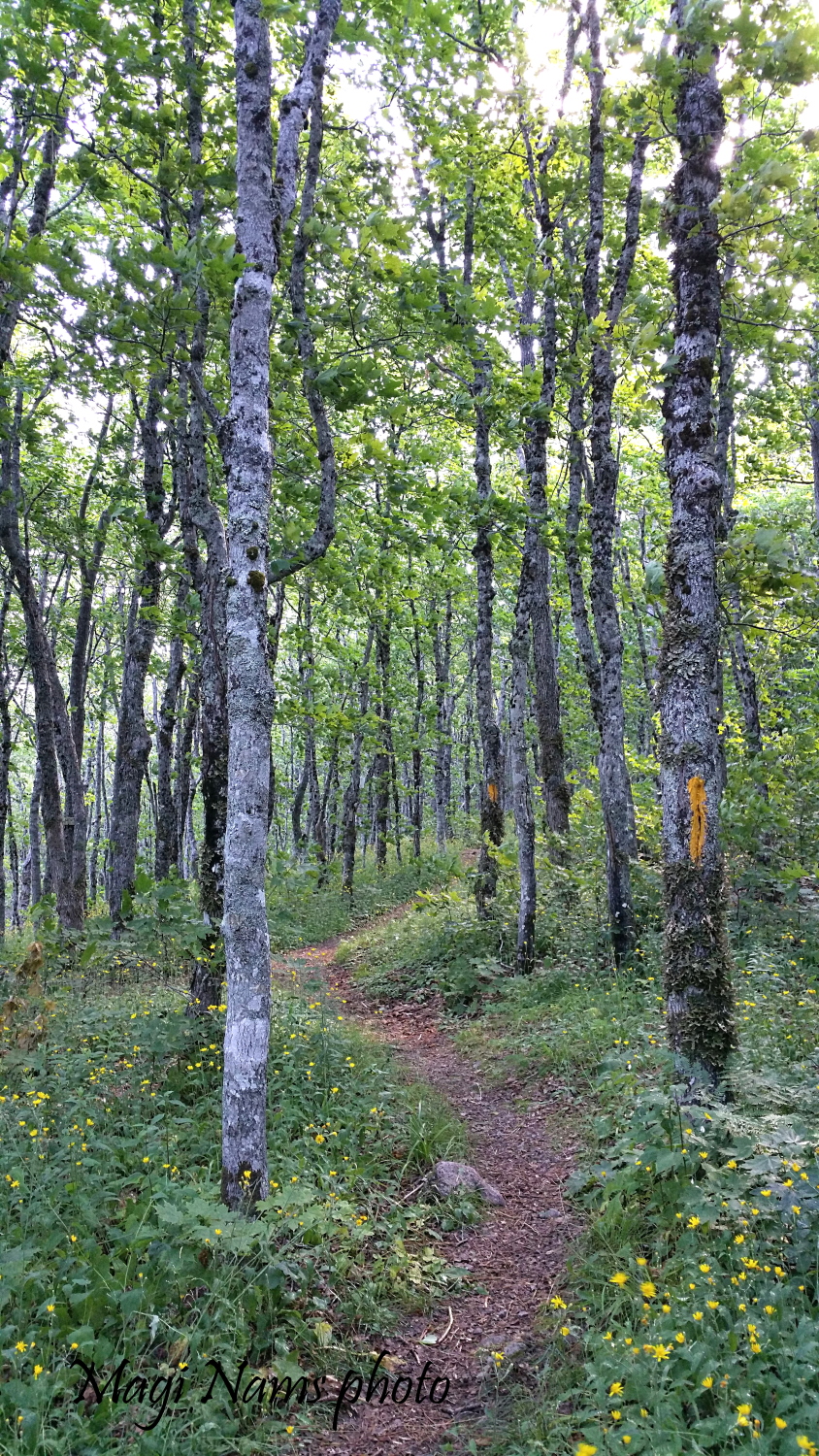
Hking Fitzpatrick Mountain Trail (© Magi Nams)
The most popular section of Fitzpatrick Mountain Trail is the 8-kilometre segment between the village of Scotsburn (on Hwy 256, about 12 kilometres west of Pictou) and Millsville Road.
The Scotsburn trailhead is located at the rear of the recreation park adjacent to Scotsburn Elementary School (on Hwy 256). Look for the trailhead sign to the right of the baseball field. There’s a trail map in a kiosk in the recreation park carpark. Check the map out below. In my photo, I added bright green dots at the two trailheads.
The Millsville Road trailhead can be found by taking Durham Road, at the east end of Scotsburn, south to its intersection with Millsville Road; turn right onto Millsville Road and travel about 6 kilometres. After you pass Irving Young Road on your right and then a farm on your left, keep an eye out for trail markers with the red Cape to Cape Trail logo (check it out in the photo after the one below) on both sides of the road. If you reach New Road, you’ve gone too far. To hike to Scotsburn, enter the trailhead on the north side of Millsville Road.
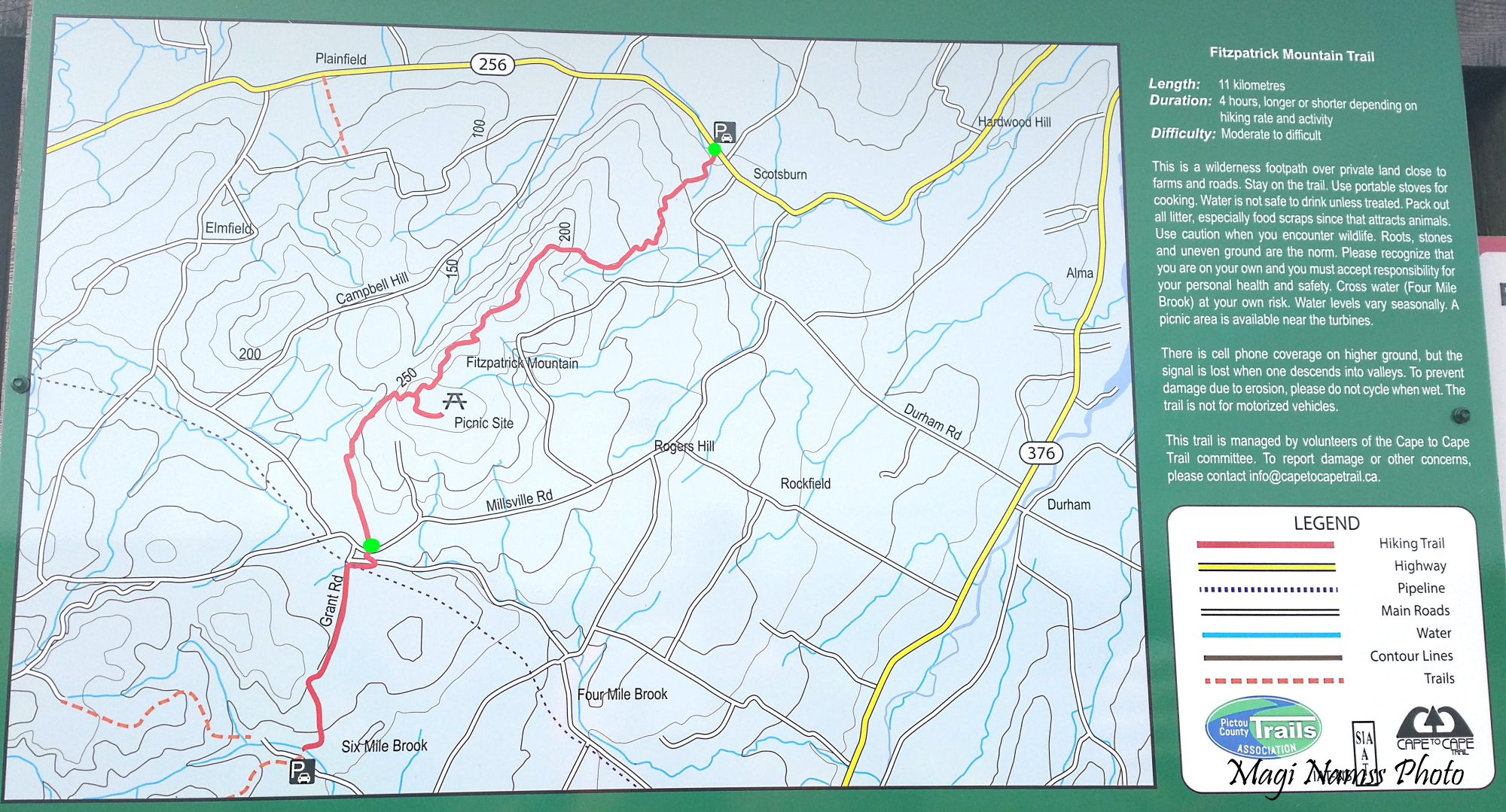
Fitzpatrick Mountain Trail Map (© Magi Nams)
Over the years, I’ve hiked sections of the Scotsburn—Millsville Road trail segment in summer and winter with my husband, Vilis, and our sons. A few years ago, a friend and I hiked the complete 8-kilometre trail while Vilis cycled it and then rode back to Scotsburn and returned with our car to collect me and my hiking buddy. To date, I’ve always started from the Scotsburn trailhead. (Detailed instructions for hiking the trail from Millsville Road to Scotsburn can be found here. ).
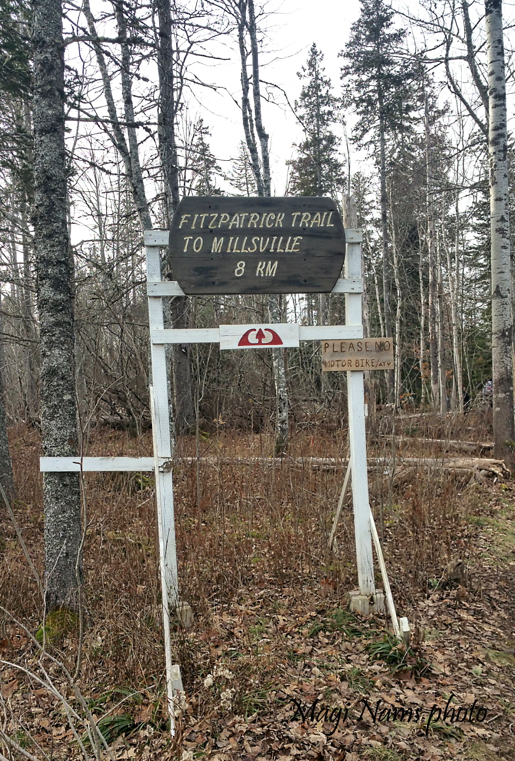
Trailhead sign for Fitzpatrick Mountain Trail, Scotsburn, Nova Scotia, with the red Cape to Cape Trail logo under the main sign (© Magi Nams)
Most recently, I hiked the 8-kilometre segment to Millsville Road with three friends on December 8, 2021. We met at the recreation park in Scotsburn, dropped my car off at the Millsville Road trailhead, and returned to Scotsburn in order to hike the trail from north to south.
With a snowstorm forecast to begin in late afternoon, we started out on the trail at 10:30 a.m. in calm, overcast conditions—the classic lull before the storm. The first section of trail led us through mixed-wood forest in which young schoolchildren were enjoying an outing beside a small brook. Farther on, we crossed the brook on a sturdy, obviously-new bridge and enjoyed the soothing, refreshing sounds of running water as we hiked beside the brook through mature hemlock forest (see opening photo).
The temperature was right around freezing, so we kept moving at a good pace. After exiting the hemlock woodland, we crossed the access road (Fitzpatrick Mountain Road) leading to Stonehame Lodge & Chalets and hiked uphill through mixed-wood forest.
All of Fitzpatrick Mountain Trail is on privately-owned land, and during our hike, we caught glimpses of a few homes and passed an old stone wall that gave evidence of earlier residents having lived on the mountain. A network of biking trails skirts the hiking trail to the west, but we had no trouble following our path, which was well-marked with signposts at trail intersections, and with small flags or painted markers on trees.
Stone wall alongside Fitzpatrick Mountain Trail; photo taken in July (© Magi Nams)
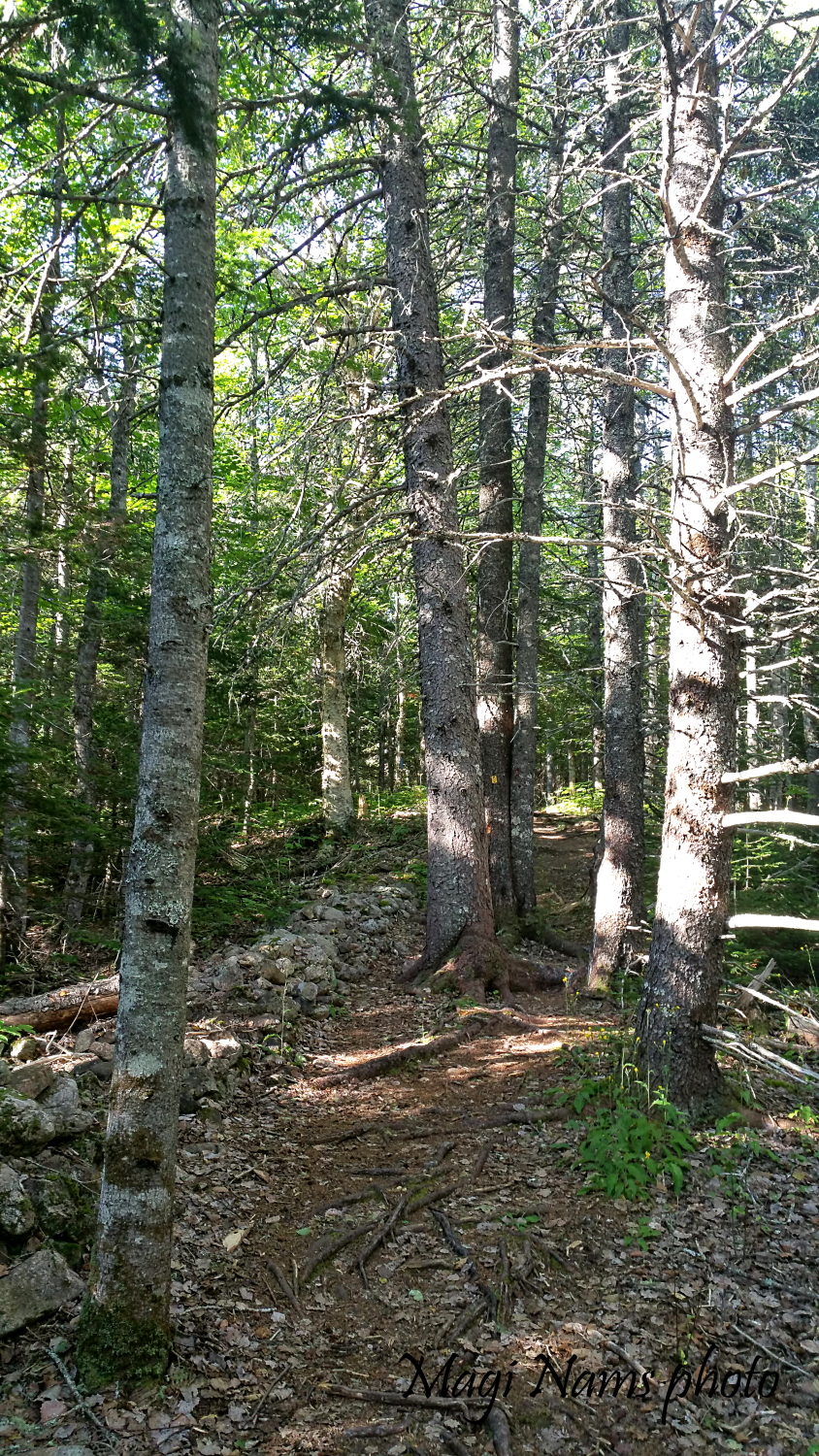
Fitzpatick Mountain Trail, showing painted trail markers; photo taken in July (© Magi Nams)
As we continued climbing Fitzpatrick Mountain, the trail near Stonehame Lodge passed through a meadow (likely once a farm field) colonized by evergreen and deciduous tree saplings. When we turned to look back the way we’d come—from the north—we enjoyed a panoramic view of ranges of hills and valleys. In December, the meadow plants were brown and dry, but I’ve seen that meadow in the height of summer, when goldenrod and fireweed splashed bright yellow and purple across the field (see photo at end of post).
On summer hikes I’ve done, the various habitats through which the trail passed were alive with birds. On July 22, 2017, I recorded the following species during a 95-minute hike of the northern part of the trail: European starling (at the trailhead), American crow, red-eyed vireo, white-throated sparrow, eastern wood-peewee, blue jay, blue-headed vireo, American robin, hermit thrush, black-throated green warbler, red-breasted nuthatch, black-capped chickadee, pileated woodpecker, northern flicker, ovenbird, song sparrow, American goldfinch, yellow warbler, northern parula, golden-crowned kinglet, winter wren, and (possibly) broad-winged hawk.
The recent December hike was much quieter, with only the voices of red squirrels, chickadees, and a blue jay to break the stillness. Beyond Stonehame Lodge, my friends and I hiked past a telecommunications tower in a clearing, then soon entered open hardwood forest dominated by maple and beech trees. During summer hikes, the deciduous woodland offered welcome shade and a rich groundcover of ferns and herbaceous plants. In December, with most of the deciduous leaves fallen (beech leaves still clinging tenaciously to twigs), we could see through the forest to valleys and hills to the west of Fitzpatrick Mountain.
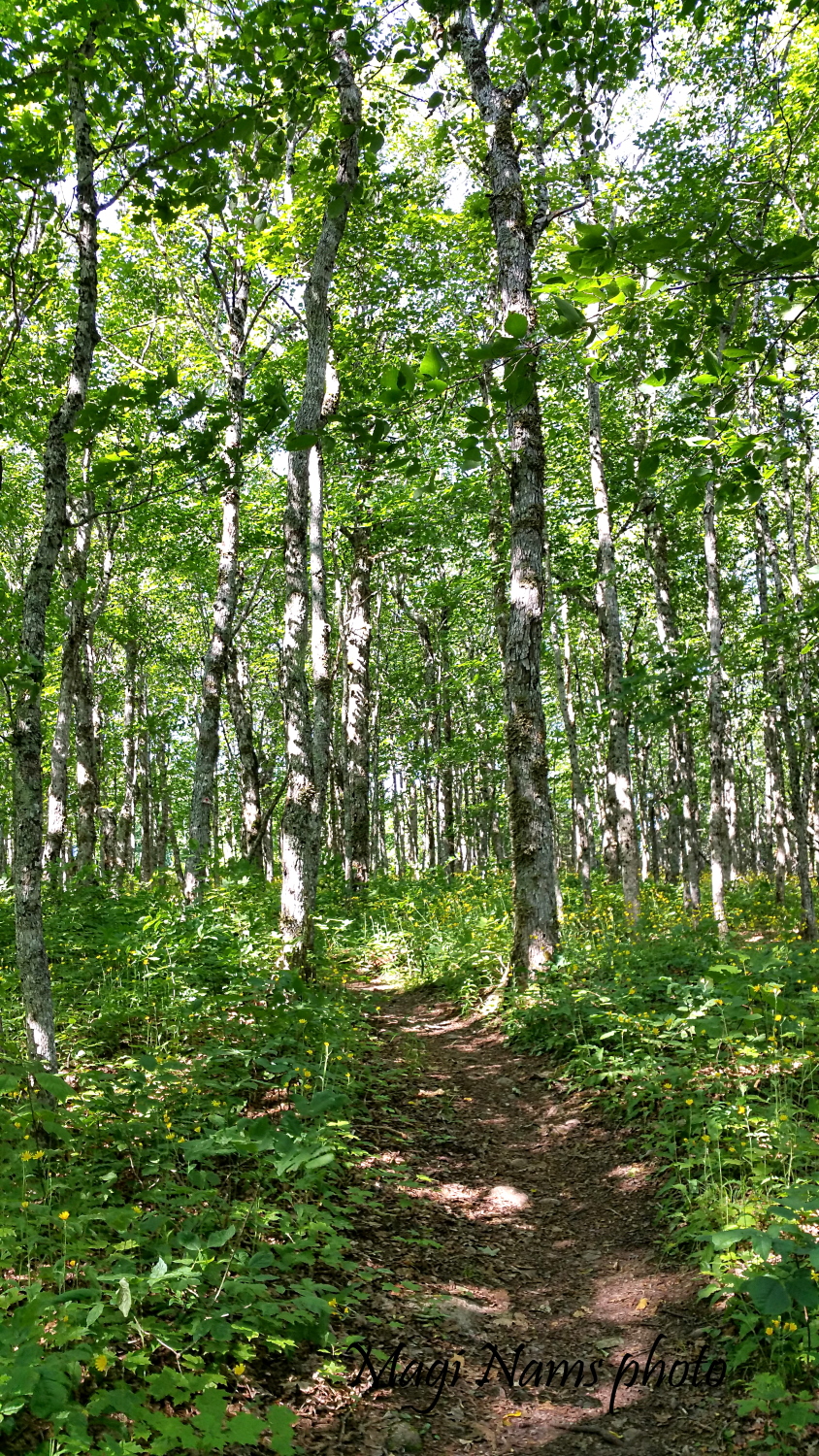
Hardwood Forest, Fitzpatrick Mountain Trail; photo taken in July (© Magi Nams)
We paused to eat picnic lunches, sitting on a log or the forest floor, soaking up the forest ambience. Unfortunately, bare hands got cold fast, so we again slung our packs back on our backs and hiked on. As elevation increased, the size of the hardwood trees decreased, reminding us of the stunted maple-and-beech forest we’d hiked through on the summit of Rogart Mountain, near Earltown. (To read a post about hiking Rogart Mountain Trail, click here.)
The trail’s next highlight was an expansive view out over a former clear-cut and the rolling hills and farming country to the south. We hiked downhill alongside the old clear-cut, then began the final climb to the summit. A side-trail led us to one of the wind turbines on the summit (at about 275 metres above sea level—see above map). From the clearing atop the summit, we could see, to the south, wind turbines on Dalhousie Mountain, and, to the north, the Northumberland Strait and, on the horizon, a dark blur that we thought must be Prince Edward Island.
Back on the main trail, we headed downhill through more mixed woodland, pausing for a few minutes’ rest at a wooden bench in a grove of magnificent hemlocks. Carrying on, we descended a steep switchback and hiked through more mature hemlock forest and mixed woodland.
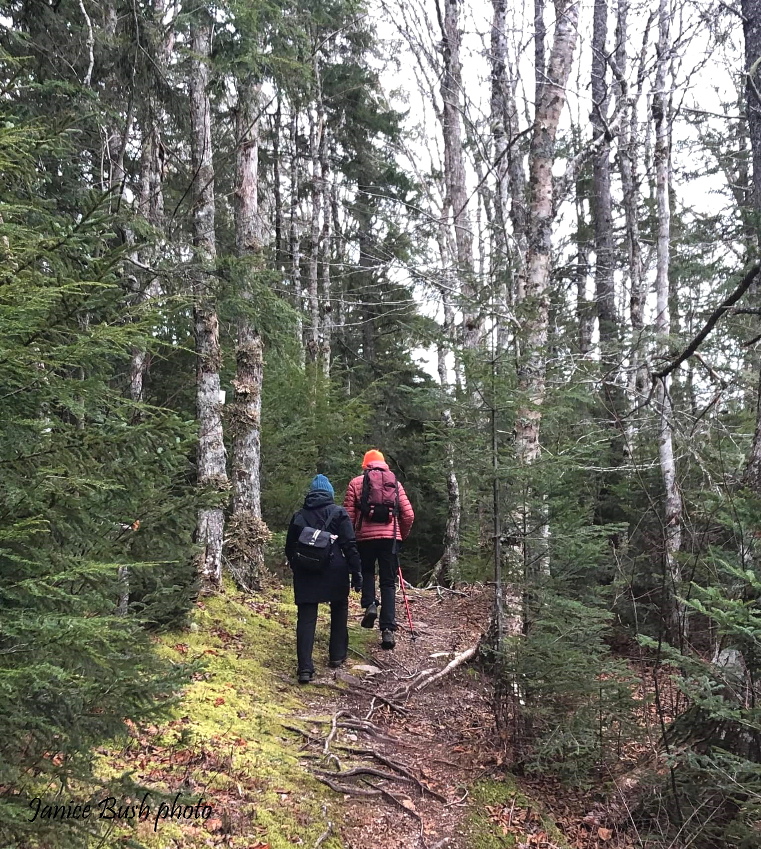
Hiking the last section of Fitzpatrick Mountain Trail (© Janice Bush)
The last part of the trail led us across a small stream, then along an old road through mixed forest for about a kilometre. As we approached Millsville Road, we spotted my red car, parked at the roadside, through the trees.
Up for a little more adventure—and with still no snow falling—we hiked south from the road on the Millsville Road—Six-mile Brook segment of the Fitzpatrick Mountain Trail in search of a waterfall I’d read about. A steep, wet (and slippery) trail led down to Four Mile Brook and the small, but pretty, upstream waterfall. Not wanting to ford the brook to continue on the trail, we retraced our steps to Millsville Road, finishing our hike at around 2:30 p.m.
As I drove home from Scotsburn, light snow began to fall. Tired but exhilarated from hours of physical activity in Nova Scotia’s beautiful outdoors, I smiled at the thought that if we’d waited until the next day to hike, we might have needed snowshoes!
If you’re in northern Nova Scotia and looking for a challenging, forest-rich hike with scenic viewpoints, Fitzpatrick Mountain fits the bill. Highly recommended.
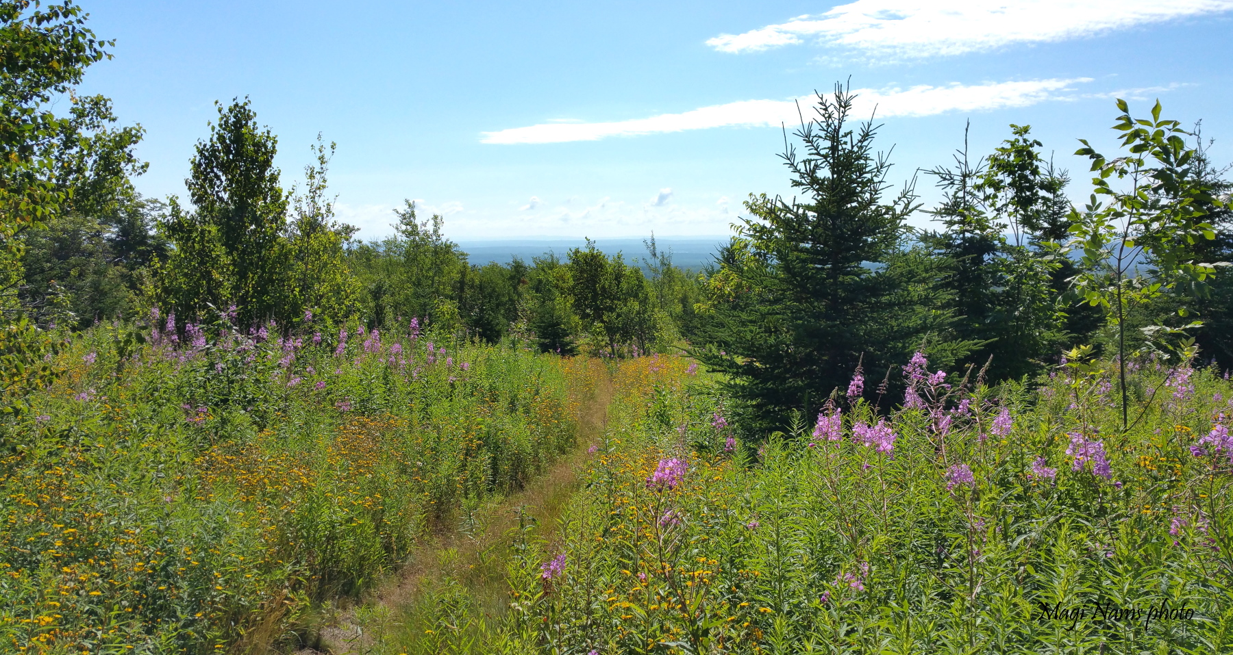
Summer view from Fitzpatrick Mountain Trail, Nova Scotia (© Magi Nams)
