Looking for a scenic hike through diverse habitats in northern Nova Scotia? Pugwash Estuary Nature Reserve boasts Acadian forest, salt marshes, and gorgeous river views.
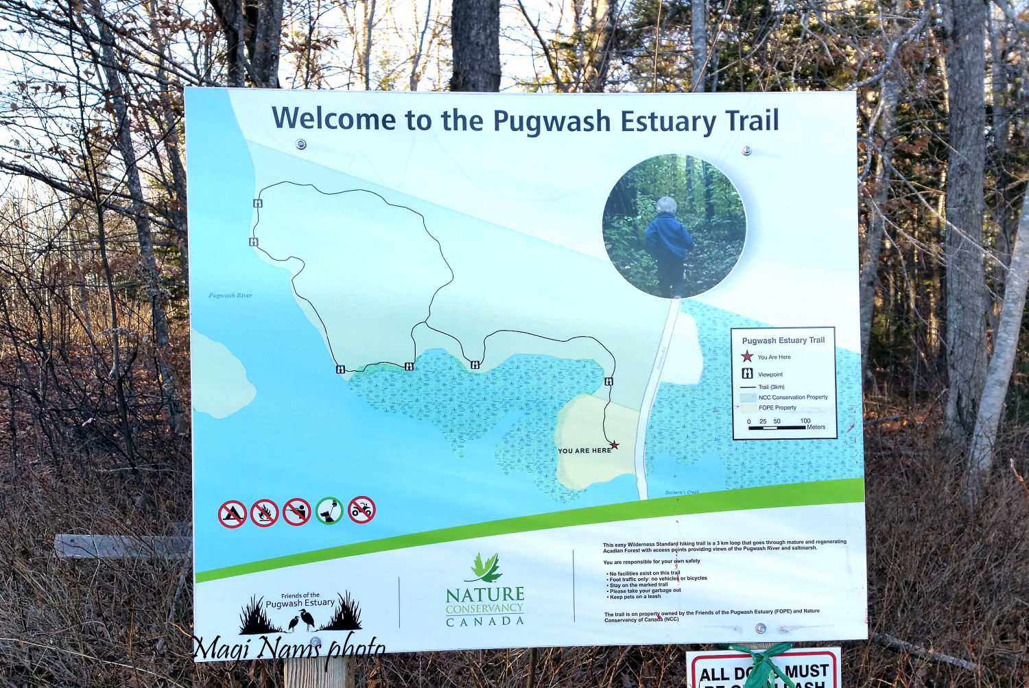
Pugwash Estuary Nature Reserve is a 550-acre mix of forest, salt marsh, and pristine coastline located 5 km south of Pugwash, on Nova Scotia’s North Shore (access at 2169 Crowley Road). Consisting of 15 properties bought by the Nature Conservancy of Canada (NCC) since 1993, the reserve protects Nova Scotia’s largest estuary on the Northumberland Strait shore from cottage-country and commercial development. 1,2
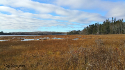
Salt Marsh in Pugwash Estuary Nature Reserve (© Magi Nams)
Pugwash Estuary Nature Reserve trails
Pugwash Estuary Nature Reserve features two trails: lollipop-shaped Estuary Trail (3.5 km return) and linear Peace Trail (4.7 km one way), the latter with a couple of side loops (0.8-km Masicho Trail and 0.9-km Kitpoo Trail). There’s roomy parking for Estuary Trail at Estuary House, 2169 Crowley Road, and limited parking for Peace Trail at the two trailheads.
Note that the northern trailhead of Peace Trail is .6 km south of Estuary House on Crowley Road (see map), and the southern trailhead is on Thompson Road, about 2.4 km from Estuary House. If you’re hiking with a group, I suggest taking two vehicles and leaving one at each end of the trail. When I hiked Peace Trail on my own, I had to walk gravel roads for 30 minutes to get back to my car, after finishing the hike.
Pugwash Estuary Nature Reserve trails are maintained by volunteers from NCC and Friends of Pugwash Estuary (FOPE), a local organization dedicated to preserving the Pugwash River estuary and educating the public about the estuary’s importance as a diverse ecosystem and critical staging area for migrating shorebirds and waterfowl. Both Docherty’s Creek and Canfield Creek feed into Pugwash River within the reserve.
Estuary Trail
I’ve hiked Estuary Trail many times while assisting Pugwash Estuary bird count coordinator and FOPE president, Betty Hodgson, with spring and fall migratory bird counts and the Chritstmas Bird Count.
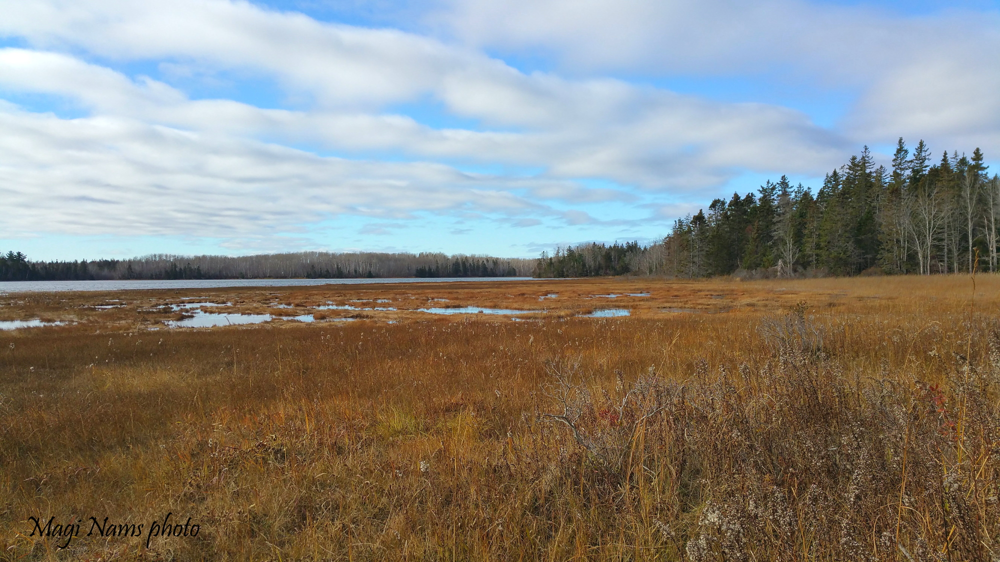
Tree Swallow (Tachycineta bicolor) at Pugwash Estuary Nature Reserve (© Magi Nams)
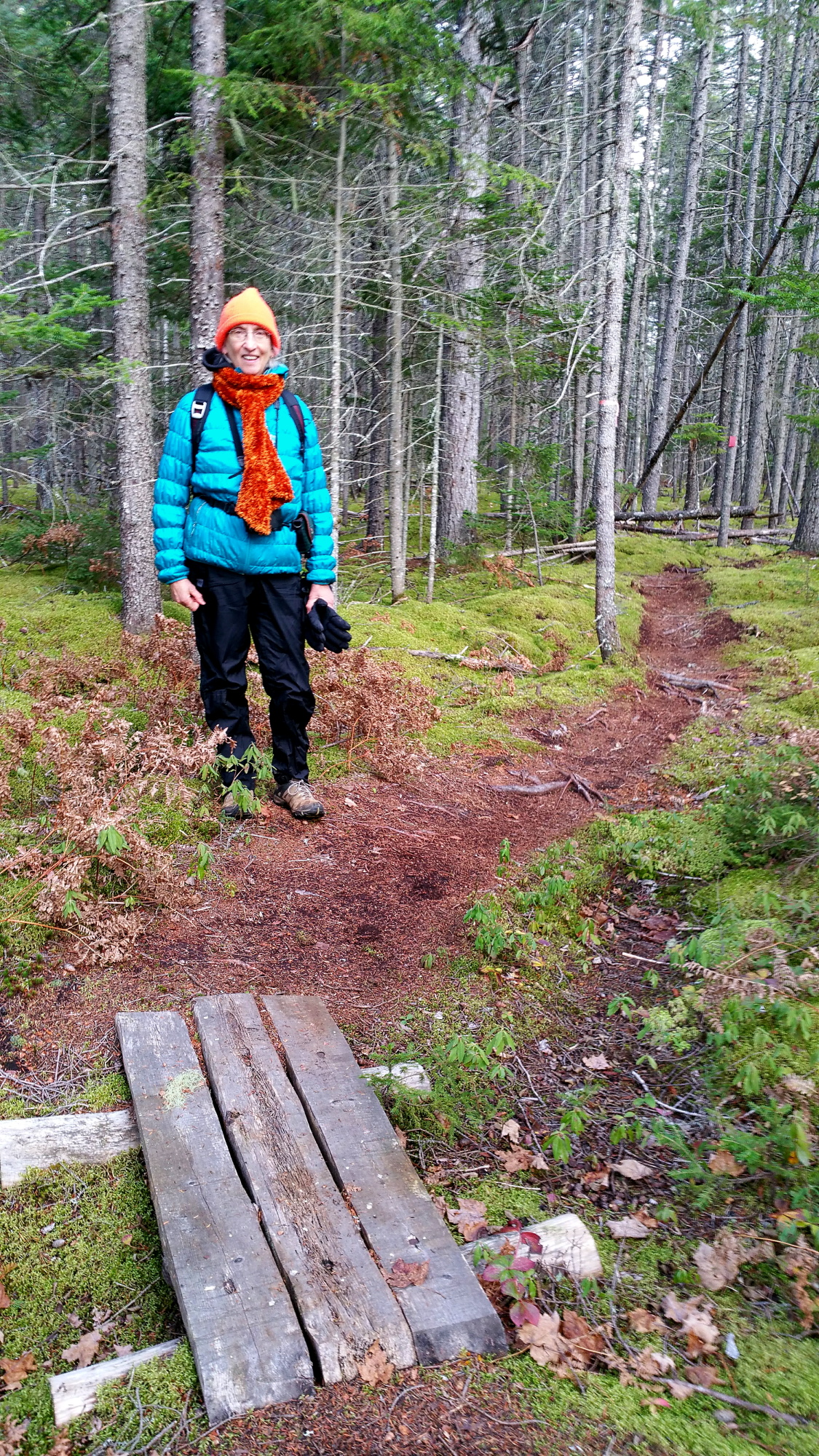
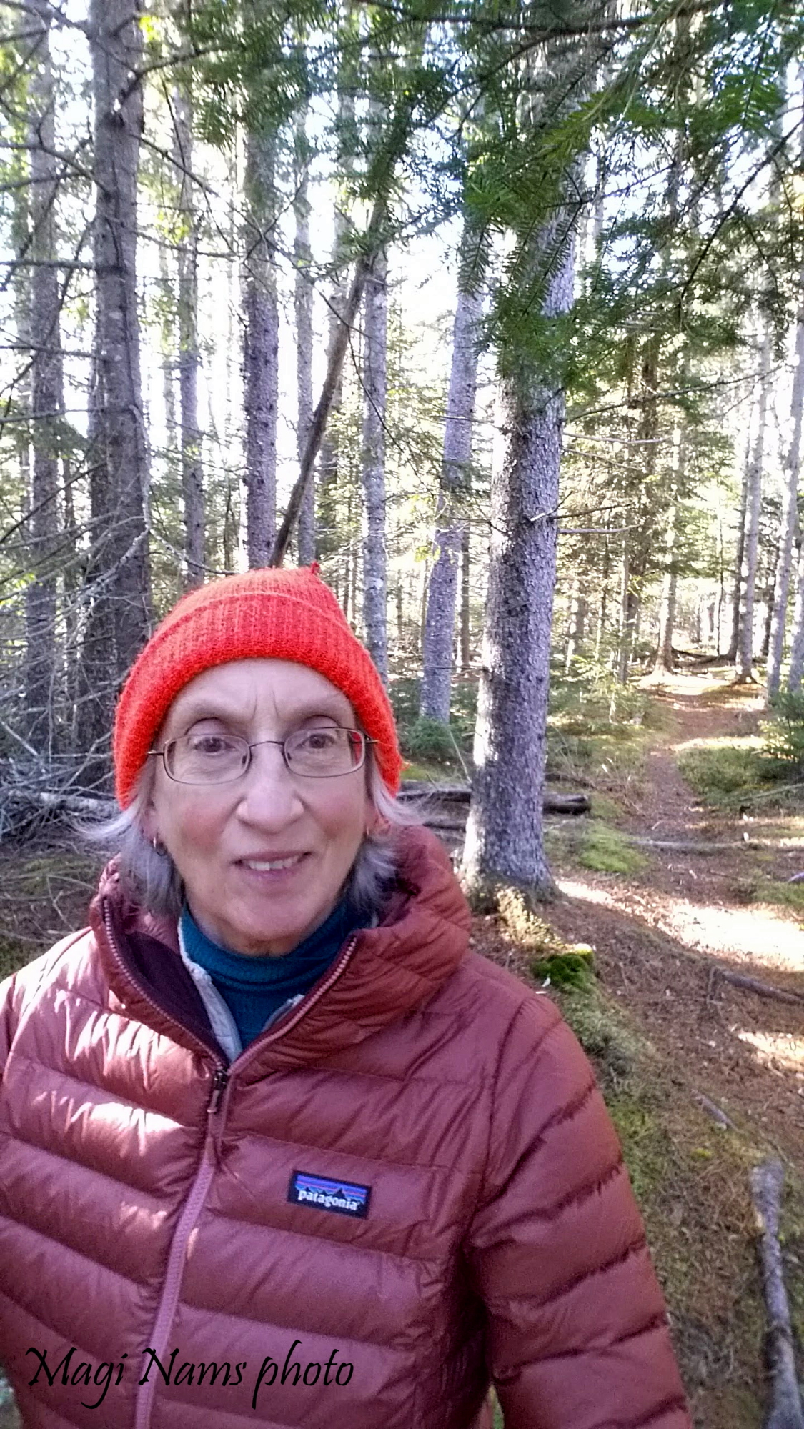
In mid-November, a friend and I hiked Estuary Trail and the southern section of Peace Trail that includes the two side loops, Masicho Trail and Kitpoo Trail.
Cool autumn weather held a mix of sun and cloud, with fresh breezes off the water as we started out on Estuary Trail in late morning.
Estuary Trail Map, Pugwash Estuary Nature Reserve (© Magi Nams)
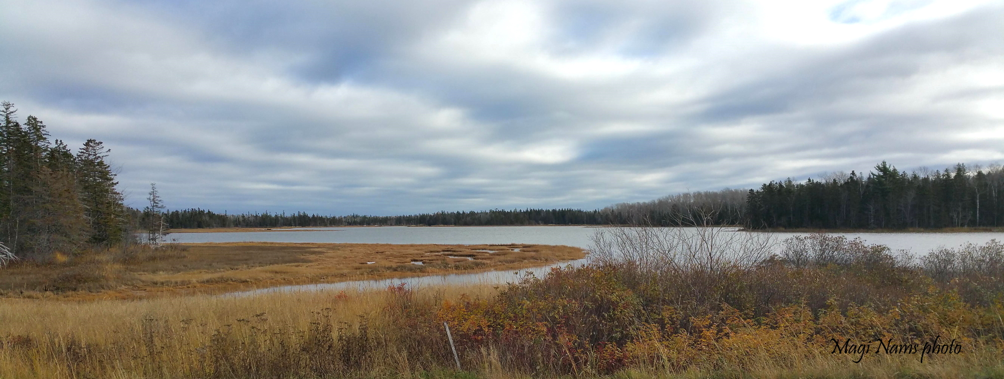
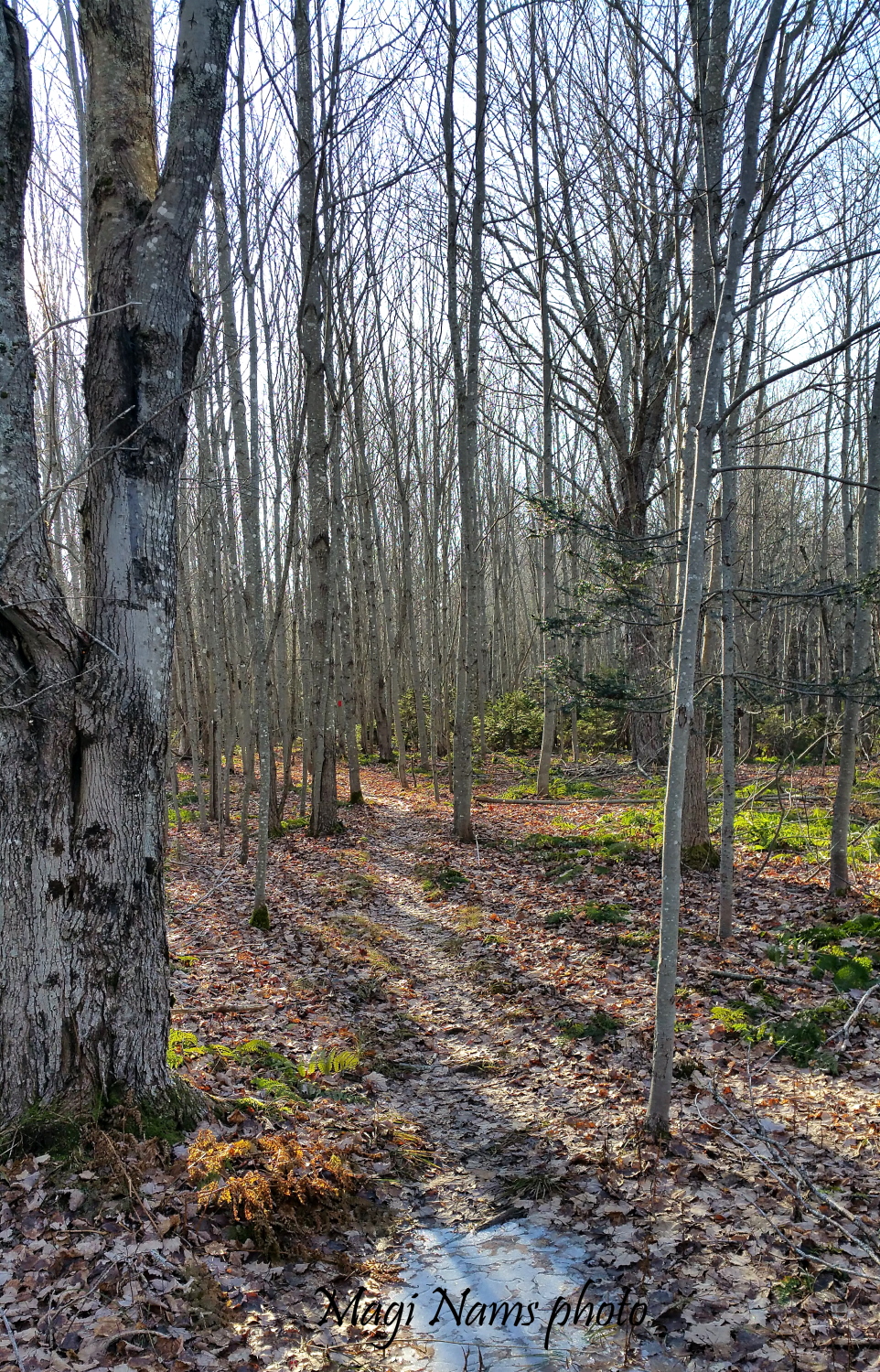
The easy, well-marked path led us through mixed-wood forest, stands of conifers with mossy groundcover, and alongside the estuary. Boardwalks aided in hiking over soggy ground, and the cheerful-sounding “dee-dee-dee” of black-capped chickadees accompanied us. This trail offered excellent views of the estuary’s shoreline salt marshes, reddish-golden in the autumn sunshine (see opening photo), and of broad Pugwash River. Back at Estuary House, we strolled to Crowley Road to photograph winding Docherty’s Creek, which flows beneath the road bridge near Estuary House, then into Pugwash River.
Hiking Estuary Trail, Pugwash Estuary Nature Reserve (© Magi Nams)
Docherty’s Creek seen from Estuary House (© Magi Nams)
Peace Trail
After completing Estuary Trail, we drove to the southern trailhead of Peace Trail on Thompson Road. Keeping left at trail intersections as we hiked north, we followed the loops created by Masicho Trail and then Kitpoo Trail through mixed-wood Acadian forest adjoining Canfield Creek before returning to the trailhead along Main Trail (about 4 km total). Along a ridge overlooking the broad creek, which feeds into Pugwash River, huge red spruce trees towered over us. We picnicked on the creek shore, overlooking a serene creek inlet washed by the tides.
Interpretive signs along the trail identified prominent tree species within the forest, discussed the history of the estuary and ecological importance of salt marshes, and informed hikers of the roles played by pileated woodpeckers, ospreys, and bald eagles within the reserve ecosystem.
Peace Trail overlooking Canfield Creek, Pugwash Estuary Nature Reserve (© Magi Nams)
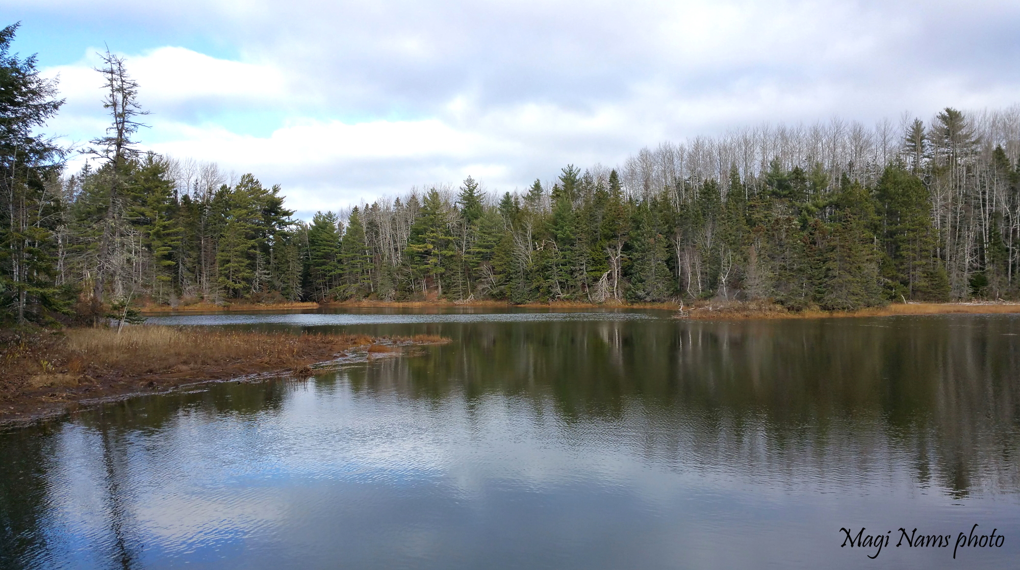
Canfield Creek inlet, Pugwash Estuary Nature Reserve, seen from Peace Trail (© Magi Nams)
The entire Peace Trail is rated as moderately difficult, and it has steep sections. Again, the trail was well-marked, with boardwalks or corduroy logs to grant passage over wet areas. We returned to the southern trailhead via Main Trail through more mixed-wood forest. Our total hiking time for Estuary Trail and the south Peace Trail was 3.5 hours, including a leisurely lunch break.
Two days ago, I returned to Pugwash Estuary Nature Reserve and hiked the entire Peace Trail’s Main Trail from north to south on a sunny, brisk Saturday afternoon. The temperature was -3° C when I set out, and -1° C when I returned to my car. With only three hours of good light remaining in the day, I booted it along the trail. As it turned out, I need not have worried about getting caught out in the woods at dark, since I hiked the 4.7-km distance in 1.5 hours, after which I walked briskly back to my car to complete the 7.1-km loop in 2 hours.
On Peace Trail, Pugwash Estuary Nature Reserve (© Magi Nams)
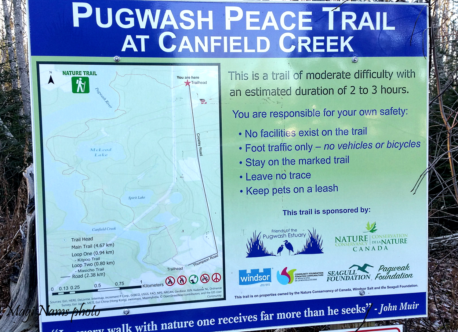
Peace Trail map, Pugwash Estuary Nature Reserve (© Magi Nams)
As I hiked, frozen leaves on the forest floor crunched underfoot, and I skirted puddles left by recent heavy rains, some coated with ice. Ice and a dusting of snow also edged the estuary shoreline, with the broad blue Pugwash River flowing into the distance.
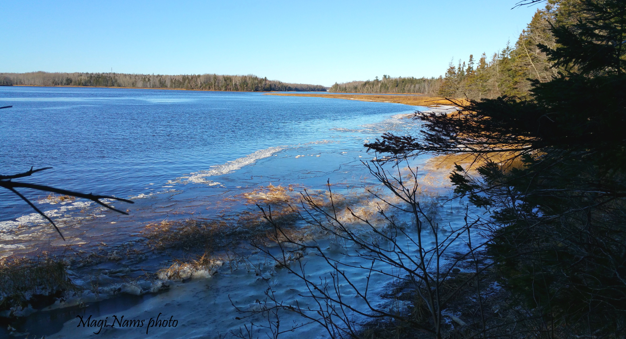
Pugwash River viewed from Peace Trail (© Magi Nams)
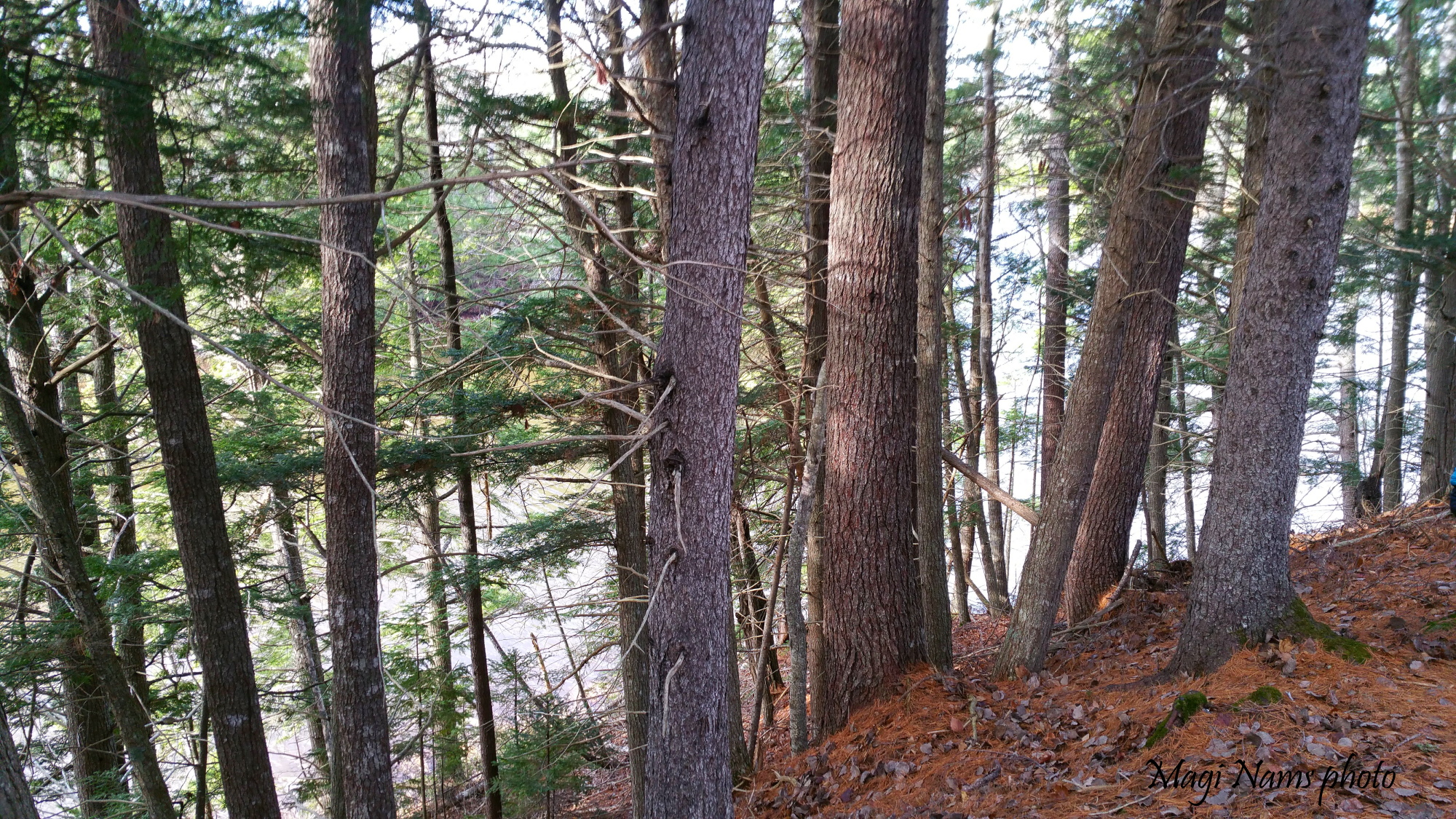
Rich Acadian forest surrounded me. On the northern section of the trail, lofty red pines towered over me, and as I hiked south, trail signs pointed out impressive specimens of white spruce, tamarack, red spruce, and eastern hemlock. The trail passed through distinct forest types: mixed-wood with big birches and aspens, mossy coniferous forest, open mixed forest dominated by those massive pines, a stand of hardwoods dominated by maples, and then, as I approached the junction of Main Trail and Kitpoo Trail, more mixed-wood forest.
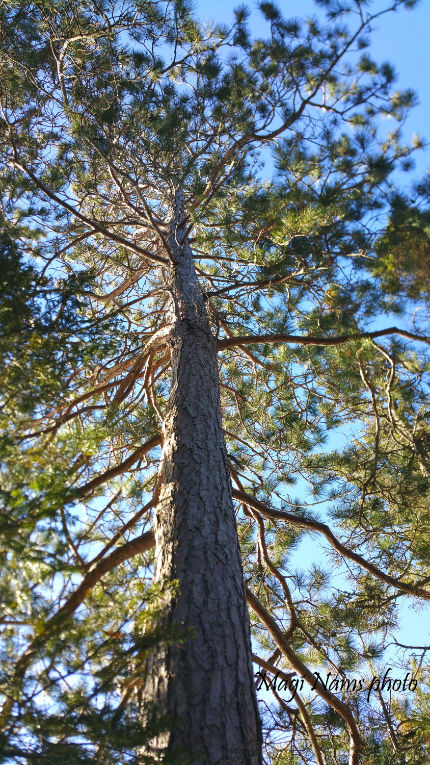
Red pine (Pinus resinosa) on Peace Trail, Pugwash Estuary Nature Reserve (© Magi Nams)
Hardwood Forest, Peace Trail, Pugwash Estuary Nature Reserve (© Magi Nams)
The early December afternoon was a quiet one, with only a few red squirrels chattering out their territorial dominance, the voices of black-capped chickadees, a red-breasted nuthatch, a crow, and perhaps a crossbill lighting the air with sound, and the wings of a pair of ducks flying along the shoreline beating the air. However, as I hiked south toward the trail’s end (repeating the last section of trail hiked in mid-November), sight made up for lack of song. An adult northern goshawk flushed from a tree and winged across the path ahead of me, its slate grey back, grey-and-white-barred belly, and dark-grey-marked head clearly visible in the clear afternoon light. What a thrill!
After finishing the hike, I turned left and walked speedily along gravel Thompson Road, then turned left again onto Crowley Road en route to my car. My goshawk thrill was doubled when another adult hawk flew straight toward me above the road and passed overhead. Gorgeous bird!
If you’re a nature enthusiast looking for a scenic hike through diverse habitats in northern Nova Scotia, check out Pugwash Estuary Nature Reserve. Highly recommended.
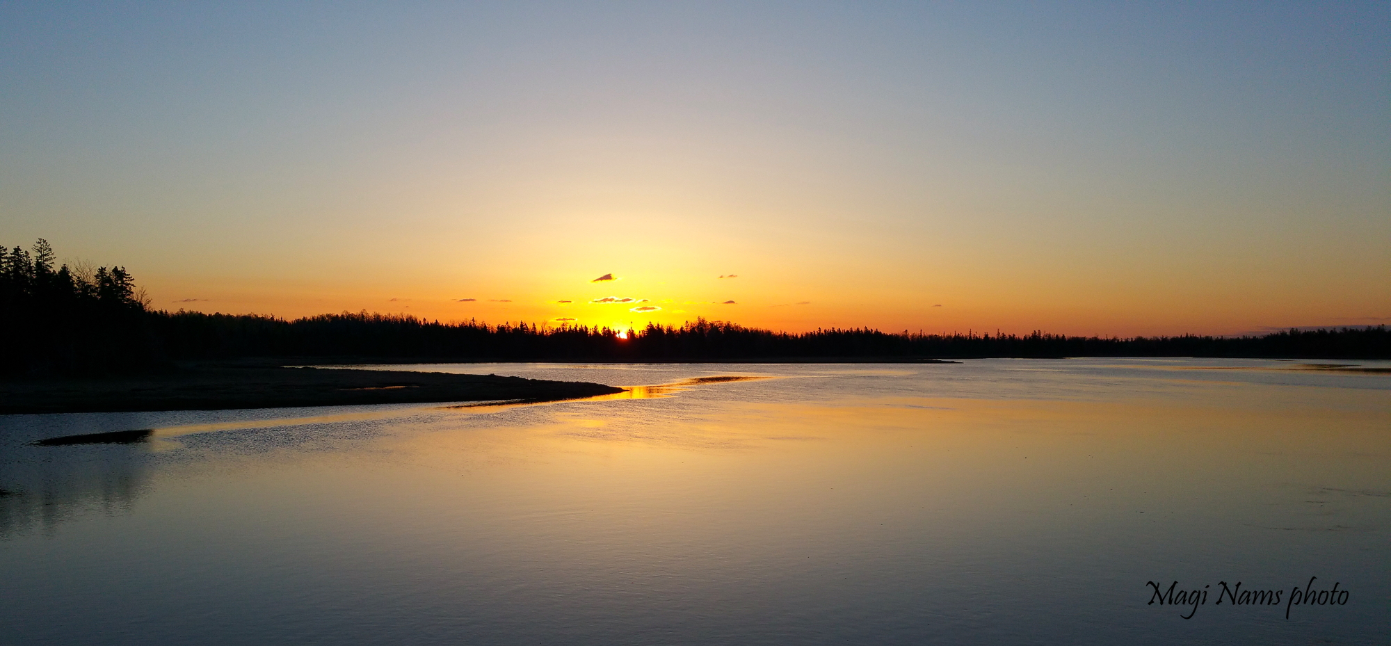
Sunrise over Docherty’s Creek, Pugwash Estuary (© Magi Nams)
Sources:
- Stephen Cooke. Spruced-up trails make Pugwash Estuary a must-visit spot for hikers, birders. Saltwire, October 10, 2020. Accessed December 6, 2021. https://www.saltwire.com/nova-scotia/news/spruced-up-trails-make-pugwash-estuary-a-must-visit-spot-for-hikers-birders-508153/
- Nature Conservancy of Canada. Pugwash Estuary. Accessed December 6, 2021. https://www.natureconservancy.ca/en/where-we-work/nova-scotia/featured-projects/pugwash-estuary.html
