At 5:50 a.m., ABC Alice Springs reported the refreshing temperature of 8°C. Tree silhouettes formed black lace against the deep blue of clear, desert sky as Vilis and I drove away from The Alice, beginning our 2000-kilometre drive from the centre of Australia to the east coast of Queensland and our temporary home in Townsville. Darkness lifted into dawn, revealing red sand, the dusty-green of mulga woodland, and black kites patrolling the Stuart Highway for roadkill. At 6:19 a.m., the desert sun – a rich, scarlet ball – rolled above the horizon, washing the sky with pink and casting its light over the vast desert plain which, north of Alice Springs and the MacDonnell Ranges, stretched as a flat expanse to north, east, and west.
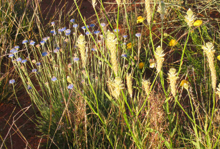
Desert Wildflowers south of Ti Tree, Northern Territory (© Vilis Nams)
South of Ti Tree, wildflowers blanketed the roadsides with colour, and at Aileron, a gigantic metal statue of an Aboriginal man holding a spear stood on the crest of a ridge like a guardian of the desert. Vilis and I drank in cool, outdoor air and realized this was likely the last time we would enjoy cool air until our return to Canada on Christmas Eve. Whistling kites cruised the roadkill breakfast bar, and a black-breasted buzzard – glorious in adult plumage of black, chestnut and white – soared in sweeping circles above the mulga.
We drove north to Three Ways, past countless power poles constructed of metal to withstand the onslaught of termites. Past Ti Tree, where an Aboriginal language flowed like music at the servo (service station). Past Tennant Creek, where red dust billowed out from under a road train pulling onto the highway, and where pages of the local newspaper were laminated as a floor covering at the BP/Red Rooster. For the first time in Australia, I saw more Aboriginal people than white people walking the streets of a major town. A glance at our road map showed that half or more of the area of the Northern Territory is Aboriginal Land Trust.

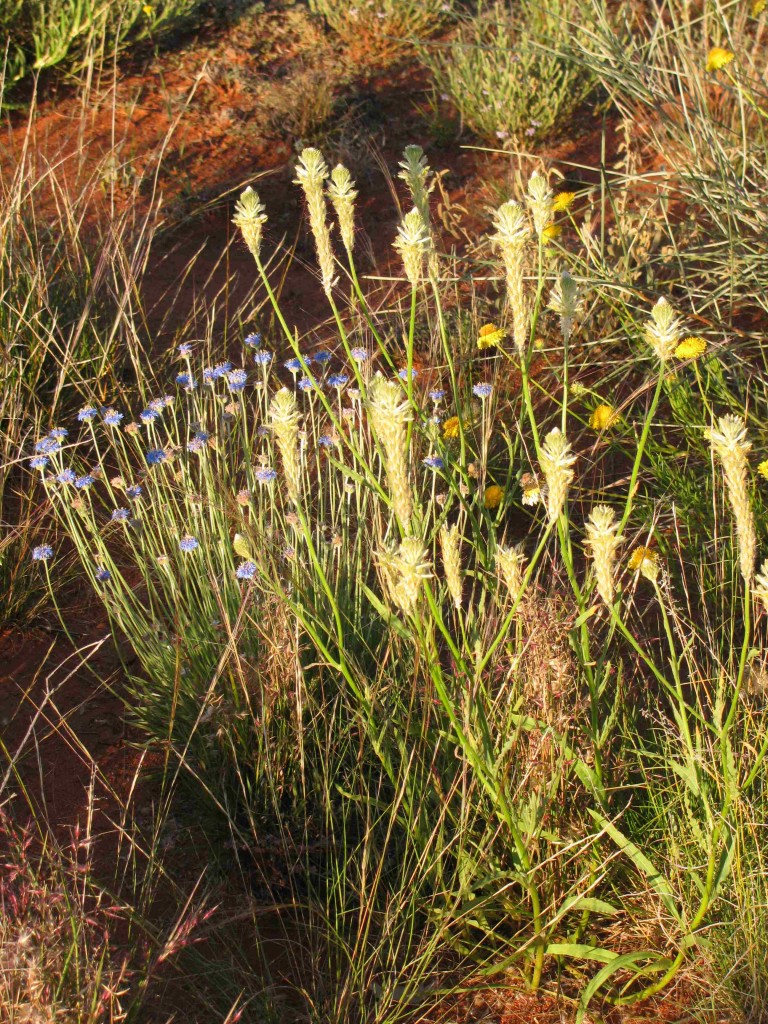
Sign near Barkly Homestead, Northern Territory (© Vilis Nams)
At Three Ways, 532 kilometres north of Alice Springs, we turned off the Stuart Highway (named for Australia’s most illustrious explorer, John McDouall Stuart, the first European to cross the continent from south to north and back again1) onto the Barkly Highway (named for Sir Henry Barkly, a governor of the state of Victoria during the late nineteenth century),2 which led us eastward toward Queensland. Again, as on the drive to the Red Centre, we crossed the raised plain of the Barkly Tableland, with its bleached, arid grasslands dominated by Mitchell grass and speckled with pockets of acacias. At Barkly Homestead, a sign put a humourous slant on the dangers of bushfires, stating, We like our lizards frilled NOT grilled, and beyond the Queensland border, flocks of sulphur-crested cockatoos seemed to welcome us back from the desert.
Twelve hours and 1155 kilometres after leaving Alice Springs, we again booked into a caravan park in Mount Isa, and once more my travel-weary eyes were soothed by river birds at dusk – dusky moorhens and Nankeen night herons – and by flocks of little corellas that perched like oversized white blossoms in riverbed shrubs and shoreline trees. Darkness fell to the sound of rainbow lorikeets and red-winged parrots squawking in the caravan park trees. Then, halfway home from the Red Centre, we slept.
References:
1. Wikipedia. Stuart Highway. Updated 30-Sep-2010. Accessed 6-Oct-2010. http://en.wikipedia.org/wiki/Stuart_Highway
2. Wikipedia. Barkly Tableland. Updated 3-Jul-2010. Accessed 6-Oct-2010. http://en.wikipedia.org/wiki/Barkly_Tableland
