
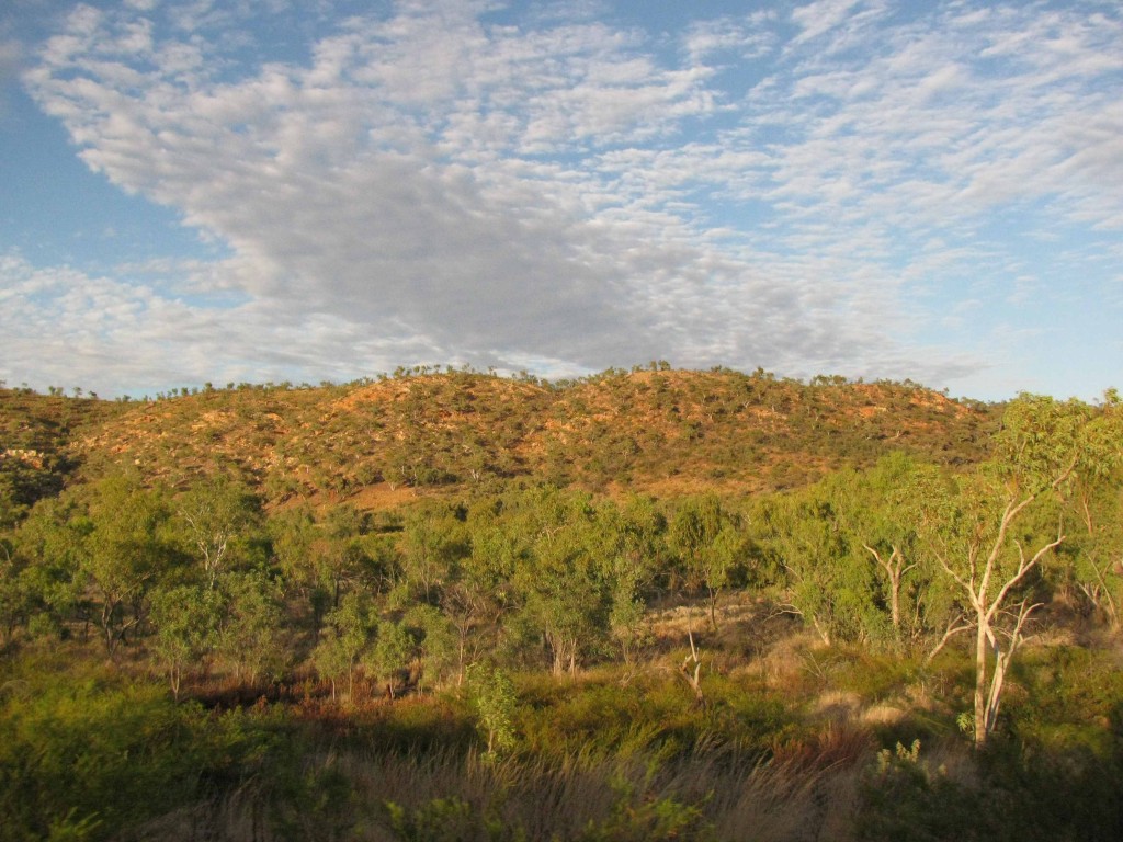
Rocky Upland West of Mount Isa (© Magi Nams)
At 6 a.m., flying foxes painted black, flapping silhouettes against a starry sky lit by a big moon, and blue-winged kookaburras brayed and chortled a raucous welcome to the day. Forty-five minutes later, Vilis and I drove away from Mount Isa, northwest toward Camooweal and the Northern Territory border. Rocky uplands bore scrubby vegetation of stunted trees and shrubs, while lowlands adjacent to the highway were cloaked with pale green hummocks of spinifex grasses, as well as acacias and eucalypts leaved in dusty green and grey. Low, morning sun gilded the grasses and trees beneath a rich blue sky not yet bleached by the stark light of midday.
Eighty kilometres west of Mount Isa, Vilis commented that the landscape was beginning to resemble that in which he and Janis had worked in Western Australia in May and June – the mulgas (acacias), the spinifex, the red soil, and the termite mounds that could be likened to stalagmites projecting upward from the floor of a vast, blue-roofed cavern.
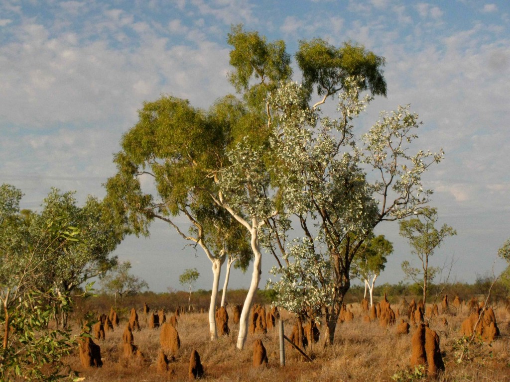
Termite Mounds in Pasture West of Mount Isa (© Magi Nams)
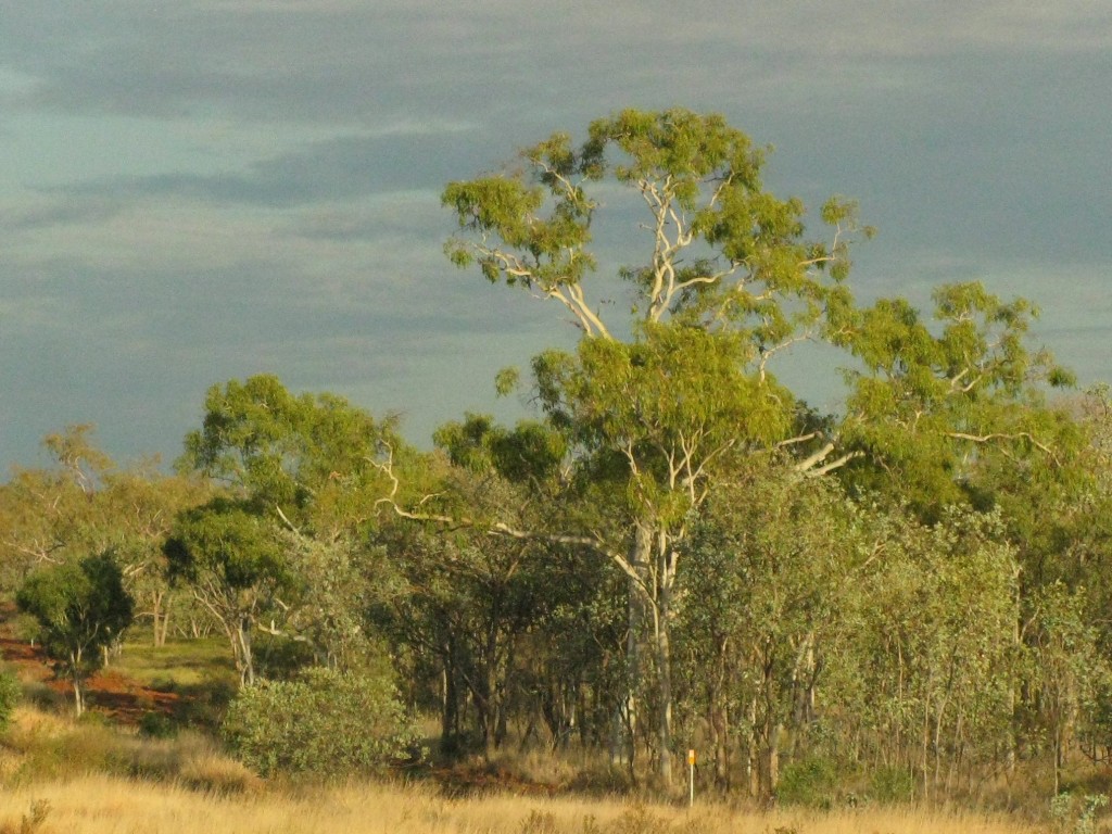
Gum Tree and Shrubs Lit by Morning Sun (© Magi Nams)
A wedge-tailed eagle lifted from roadkill on the highway, and galahs and sulphur-crested cockatoos decorated roadside trees with avian blossoms. A bustard stood in sudden prairie of grasses bleached to the colour of old gold. Camooweal, with its Drovers’ Camp and population of 310, seemed to exude an essence of rugged, self-sufficient Outback Australia cattle country. West of Camooweal, a plain of bleached grassland covered the surface of the earth to the horizon beneath royal blue storm clouds and wind that blasted across the road, bending grasses into curves and tossing leaves of infrequent trees.
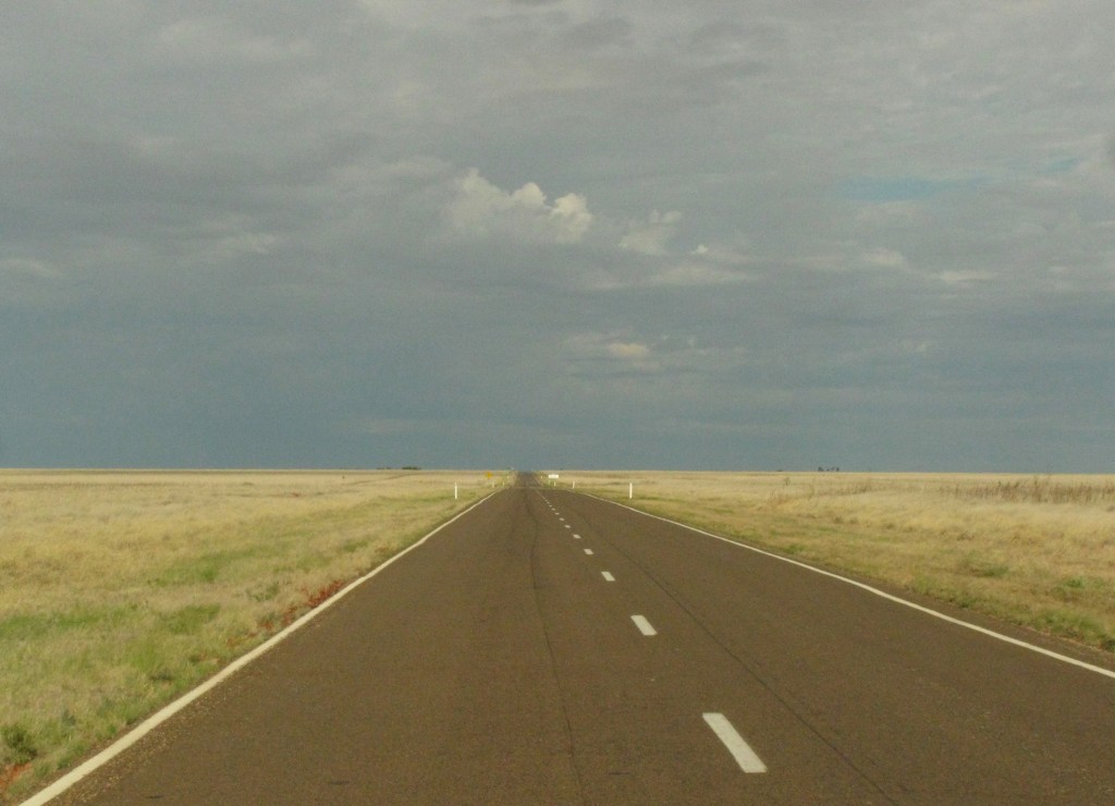
Australian Prairie West of Camooweal, Queensland (© Magi Nams)
Once we crossed the Queensland/Northern Territory border, the speed limit jumped to 130 kph on the straight, well-maintained Barkly Highway. As we pushed on toward Three Ways, that speed became addictive, a seeming necessity for traversing the vast expanses of flat, mostly uninhabited terrain we encountered. Some of it was grassland coloured with subtle hues; some mulga woodland peppered with termite mounds. Beef cattle congregated around dugouts, pink and yellow flowers bloomed on roadside plants, and strips and patches of red, orange, or purple gravel lay interspersed with vegetation. Vilis and I switched drivers every hour and a half, enjoying the refreshing air under those dark clouds promising rain, which eventually sprinkled down onto the Kia’s windshield.
At 260 kilometres west of Camooweal, we paused at Barkly Homestead – a neat collection of ranch-style buildings offering accommodation, food, and fuel – to hastily eat our picnic lunch beneath a shade tree. Cockatiels – slim grey, yellow, and white relatives of cockatoos – cavorted through the sky, and the Homestead’s public washrooms were labelled ‘Sheilas’ and ‘Blokes.’
As we travelled west from Barkly’s Homestead toward Three Ways, where the east-west Barkly Highway intersects with the north-south Stuart Highway, the vegetation around us changed constantly in a thousand permutations of colour and texture, of combinations of grasses and other groundcovers, of height and spread of shrub, and density and tortuosity of tree trunks. It was never boring.
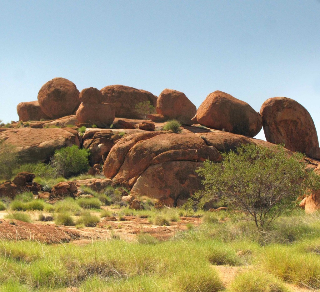
Granite Boulders of Karlu Karlu, the Devils Marbles (© Vilis Nams)
In early afternoon, we turned south onto the Stuart Highway, soon passing through Tennant Creek, the ‘Golden Heart of the Northern Territory’ founded on gold discoveries and still an important mining town. The farther south we travelled, the greener the landscape became, as though the desert country of the Red Centre was this year determined to flaunt all its beauty hidden by the aridity of most years. At Karlu Karlu, the Devils Marbles, we explored outcrops of enormous granite boulders exposed through the erosion of surrounding rock, the mid-afternoon sun scorching us with its intensity overhead and reflected from the rocks. (See October 7 – Devils Marbles, http://maginams.ca/2010/10/07/)
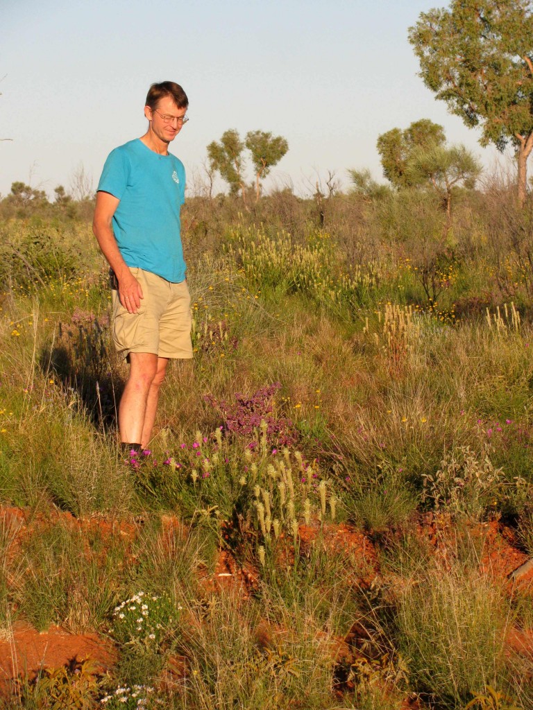
Vilis among Desert Wildflowers near Alice Springs (© Magi Nams)
As though saving the best of its rain-fed bounty for the last, the desert on the final leg to Alice Springs, south of Ti Tree, lay like a carpet of colour-speckled green on red soil. Wildflowers, shrubs, grasses, and trees blossomed in an extravaganza of fertility lit with flowers of yellow, orange, white, purple, and pink. Unable to resist, we pulled off the highway and strolled among them before driving on towards The Alice.
At 5 p.m., we noticed a flurry of bird and locust activity that lasted a half-hour or more. At 6:30 p.m., the setting sun cast its light onto grey-green mulgas, infusing them with a faint purplish hue that faded into blackness. We arrived in Alice in the dark, booked into a room in a caravan park at the north end of the city, and turned on the heat. Unlike sultry Townsville or sweltering Mount Isa, where we’d immediately turned on air conditioning in the room we’d rented last night, Alice Springs in the night was cold. We’d arrived at the Red Centre.
Today’s birds: blue-winged kookaburras, magpie-larks, rock doves, olive-backed oriole, yellow-throated miners, anhinga, Australian raven, black kites, whistling kites, apostlebirds, pied butcherbirds, red-winged parrots, crested pigeons, purple swamphen, dusky moorhen, intermediate egrets, Pacific black ducks, little corellas, Australian white ibises, chestnut-breasted mannikins, little pied cormorant, reed warbler, rainbow bee-eater, Nankeen night heron, pheasant coucal, sulphur-crested cockatoos, galahs, wedge-tailed eagle, Australian bustard, Australian magpies, little black cormorant, *cockatiels, willie wagtail, Nankeen kestrel, black-faced cuckoo-shrike. (*lifelist sighting)
