
In the darkness before dawn, kookaburras guffawed a ribald greeting to the day, their wild laughter soon joined by the medodic questioning of pied currawongs. While breakfasting on hot, sweet porridge in the campground at Undara Experience, Vilis and I watched the sunrise paint gold onto ironbarks’ black, furrowed trunks and elegantly crooked limbs reaching for the sky. It struck me as both ironic and somehow intimate that these gum trees, whose open canopies and vertically-hanging leaves I bemoan in the heat of the day – for they offer only sparse, slivered shade – I celebrate in early morn and evening when they act merely as filters, not blockades, to golden warmth and moonbeams. Their shapes have become natural to me, no longer foreign, and like Major Thomas Livingston Mitchell, the Australian colony’s first surveyor, I increasingly find them beautiful.1
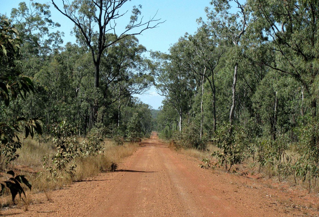
Intent on experiencing the cattle station backcountry surrounding Undara Volcanic National Park from other than a paved highway, Vilis and I headed south on the Kennedy Developmental Road and then turned east onto a dirt road that would lead us 226 kilometres cross-country to Ingham. At first straight and narrow, the road later metamorphosed into a twisting serpent of curves, hills, and sharp dips down to concrete fords or metal grid bridges that cried out the dangers of flash floods and raging torrents during the Wet. Dust billowed like a storm from a pair of road trains hauling cattle, sending Vilis and me running from our roadside picnic to the protection of the car. Cattle roamed at will across the road and through the savannah woodland, belonging to one or another of the stations whose homestead names appeared in quotation marks on the road map – “Lava Plains,” “Valley of Lagoons,” “Kangaroo Hills.” These names and others were listed on a sign marking a lonely intersection of roads.

Road Train on Queensland Backcountry Road (© Vilis Nams)
Queensland Backcountry Road (© Vilis Nams)
Intent on experiencing the cattle station backcountry surrounding Undara Volcanic National Park from other than a paved highway, Vilis and I headed south on the Kennedy Developmental Road and then turned east onto a dirt road that would lead us 226 kilometres cross-country to Ingham. At first straight and narrow, the road later metamorphosed into a twisting serpent of curves, hills, and sharp dips down to concrete fords or metal grid bridges that cried out the dangers of flash floods and raging torrents during the Wet. Dust billowed like a storm from a pair of road trains hauling cattle, sending Vilis and me running from our roadside picnic to the protection of the car. Cattle roamed at will across the road and through the savannah woodland, belonging to one or another of the stations whose homestead names appeared in quotation marks on the road map – “Lava Plains,” “Valley of Lagoons,” “Kangaroo Hills.” These names and others were listed on a sign marking a lonely intersection of roads.

Road Hazard (© Vilis Nams)
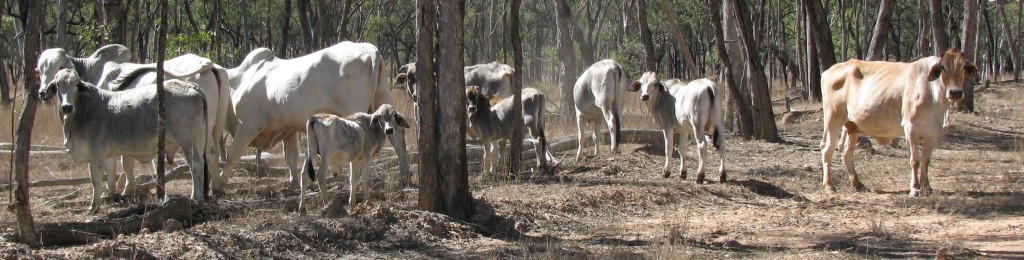
Station Cattle Beside Backcountry Road (© Magi Nams)
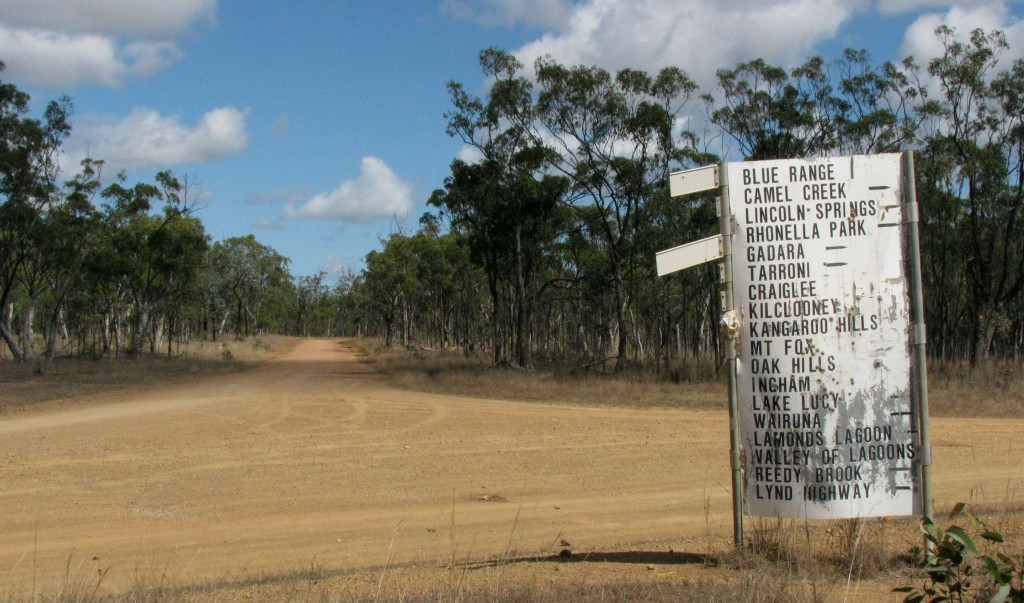
Backcountry Intersection (© Vilis Nams)
During the five hours we drove and explored that road, we passed a half dozen vehicles in addition to the road trains, as well as a dozen bikers on the stretch nearer Ingham. We paused to creep toward a long-legged bustard on a side road to Lava Plains, to photograph a squatter pigeon that bob-stepped across the red gravel into the woodland, and to drink in the beauty of ancient paperbarks edging a green creek awash with the air of fantasy at Valley of Lagoons. Pied butcherbirds called clear, musical notes from gum trees, a flock of scratchy-voiced apostlebirds pecked grit from the road, and members of the parrot order – rainbow lorikeets, galahs, pale-headed rosellas, red-tailed black-cockatoos – flew like avian blossoms and dark warriors among the sparse trees.
The road colour mimicked that of the surrounding soil and rock, changing from red to beige to yellow ochre to nearly white or purple. Anthills (or termite mounds – we haven’t yet figured out how to tell the difference by sight) protruded from the woodland floor like jutting stalagmites in an endless, open-roofed cave. An hour from Ingham, the forested peaks of Girringun National Park reared against the sky to the west, and near Mount Fox – as though a line had been drawn on the earth – the dry, greying grasses of the open woodland were suddenly replaced by lush, verdant pastures and dense vegetation rich with birds and butterflies. Our adventure among the backcountry cattle stations had ended, and Vilis drove us down through rainforest clinging to mountain slopes, down to the coastal plain and its sugarcane plantations that heralded the approach to Ingham.
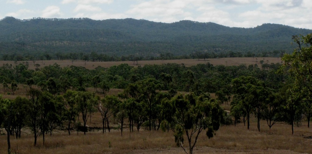
Tropical Savannah Woodland with Girringun National Park in Background (© Magi Nams)
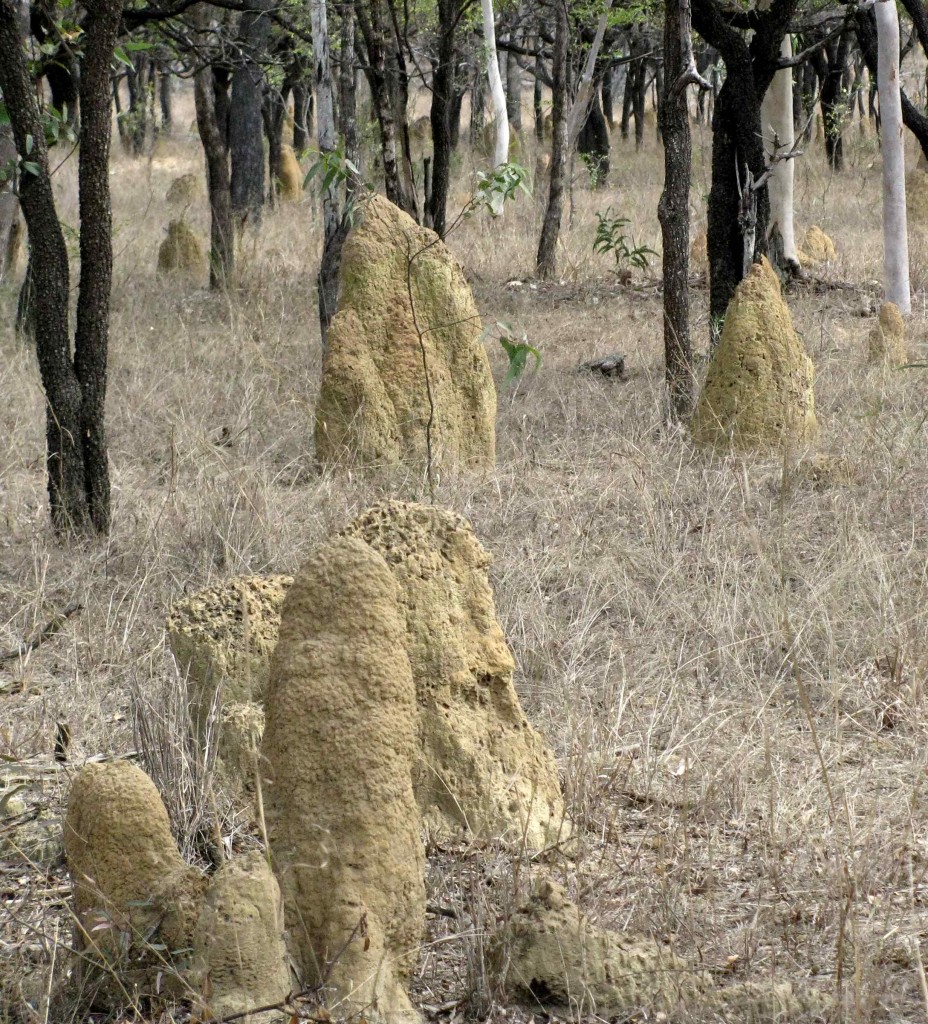
Anthills or Termite Mounds (© Vilis Nams)
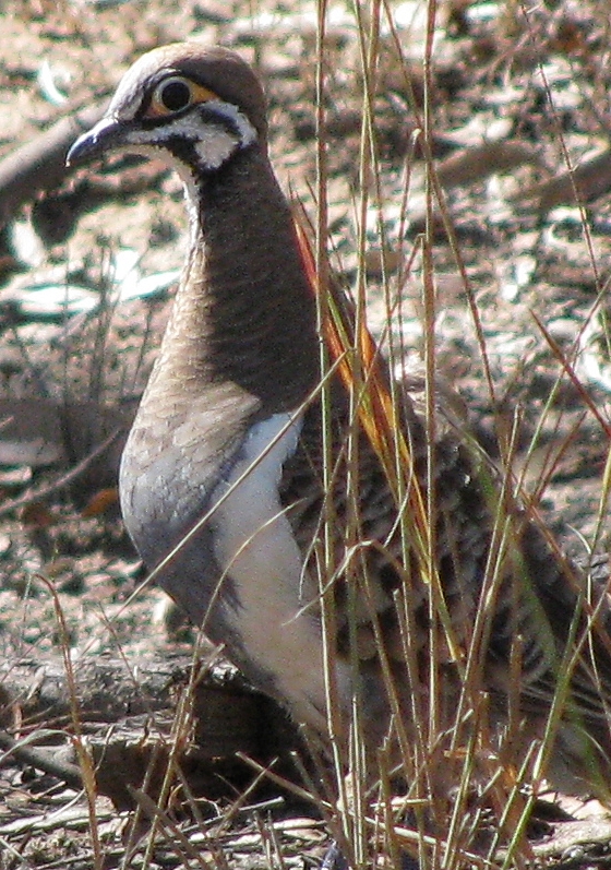
Squatter Pigeon (© Vilis Nams)
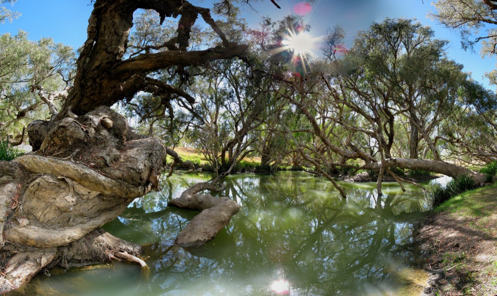
Valley of Lagoons (© Vilis Nams)
Reference:
1. Ashley Hay. Gum: The story of eucalypts and their champions. Duffy & Snellgrove, Sydney, pp. 63-64.
