Looking for a challenging wilderness hike in northern Nova Scotia? Rogart Mountain offers rugged terrain, expansive views, gorgeous hardwood forest, and an elegant waterfall.
Rogart Mountain Trail is a rigorous 6.2-kilometre forest hike near Earltown in northern Nova Scotia. The loop trail takes you through stands of mixed-wood, conifer, sugar maple, and stunted beech forest and features streams, a lovely waterfall, views of the Cobequid Hills, and settlers’ abandoned stone foundations. The trailhead is at the parking lot of Sugar Moon Farm, one of Nova Scotia’s premier maple syrup operations. From Earltown, drive about 1 kilometre south on Hwy 311, turn right onto Alex MacDonald Road, drive about 1 kilometre, and turn left into the Sugar Moon Farm parking lot. (Tap on photos to enlarge.)
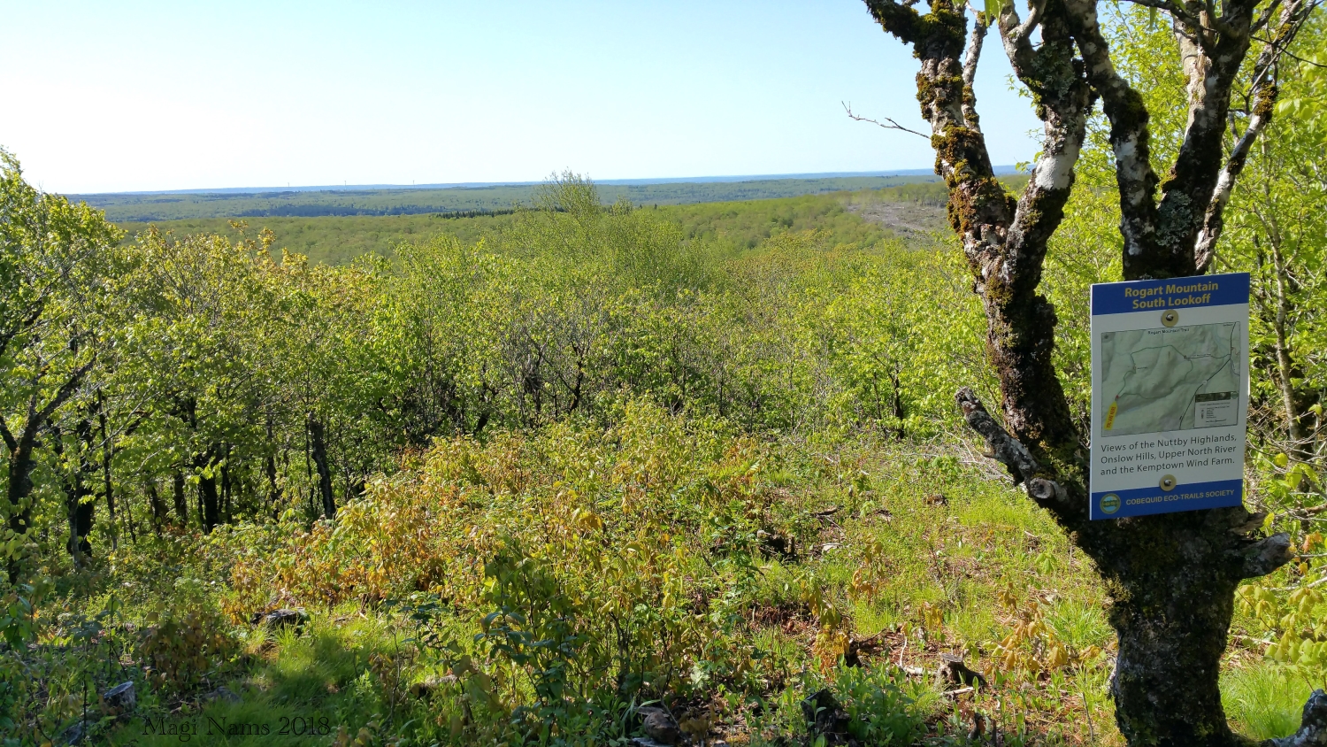
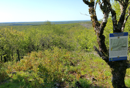
View from South Lookoff on Rogart Mountain (© Magi Nams)
Maintained by the Cobequid Eco-Trails Society, the Rogart Mountain Trail is well-marked and has interpretive signs with historical information. The suggested hiking time is 2.5 hours, but I usually hike the loop in 1.75 hours (a little longer when I’m birding!).
I’ve hiked Rogart Mountain several times and have run it once. This past spring, I hiked it again with my good friend, Dianne Jefferson. We started out at 0830, the air fresh and clean, the woods around us wet from overnight rain. The first trail section led us gently southwestward, upslope through stands of mixed forest and past a stone wall known as Bonesetter’s Wall, named for a Scottish immigrant, Peter Murray, who set bones of both humans and horses. Past the wall, we traced a hillside and then descended into the spruce-shaded ravine of New Portugal Brook, where graceful bunchberry flowers lit the forest floor like white stars.
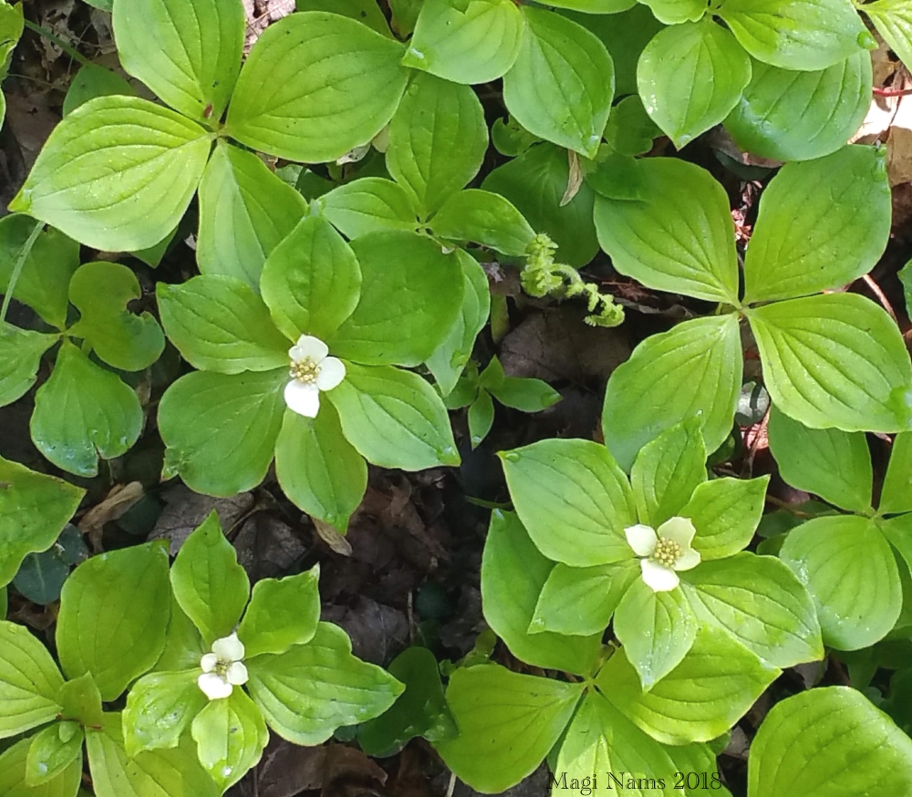
Bunchberry (Cornus canadensis) (© Magi Nams)
We followed the brook westward and then left it to begin the steep ascent of Rogart Mountain, pausing at Andrew’s Plateau—formerly the fields and pastures of Scottish settlers Andrew and Margaret Murray and family—to gaze out over the hills.
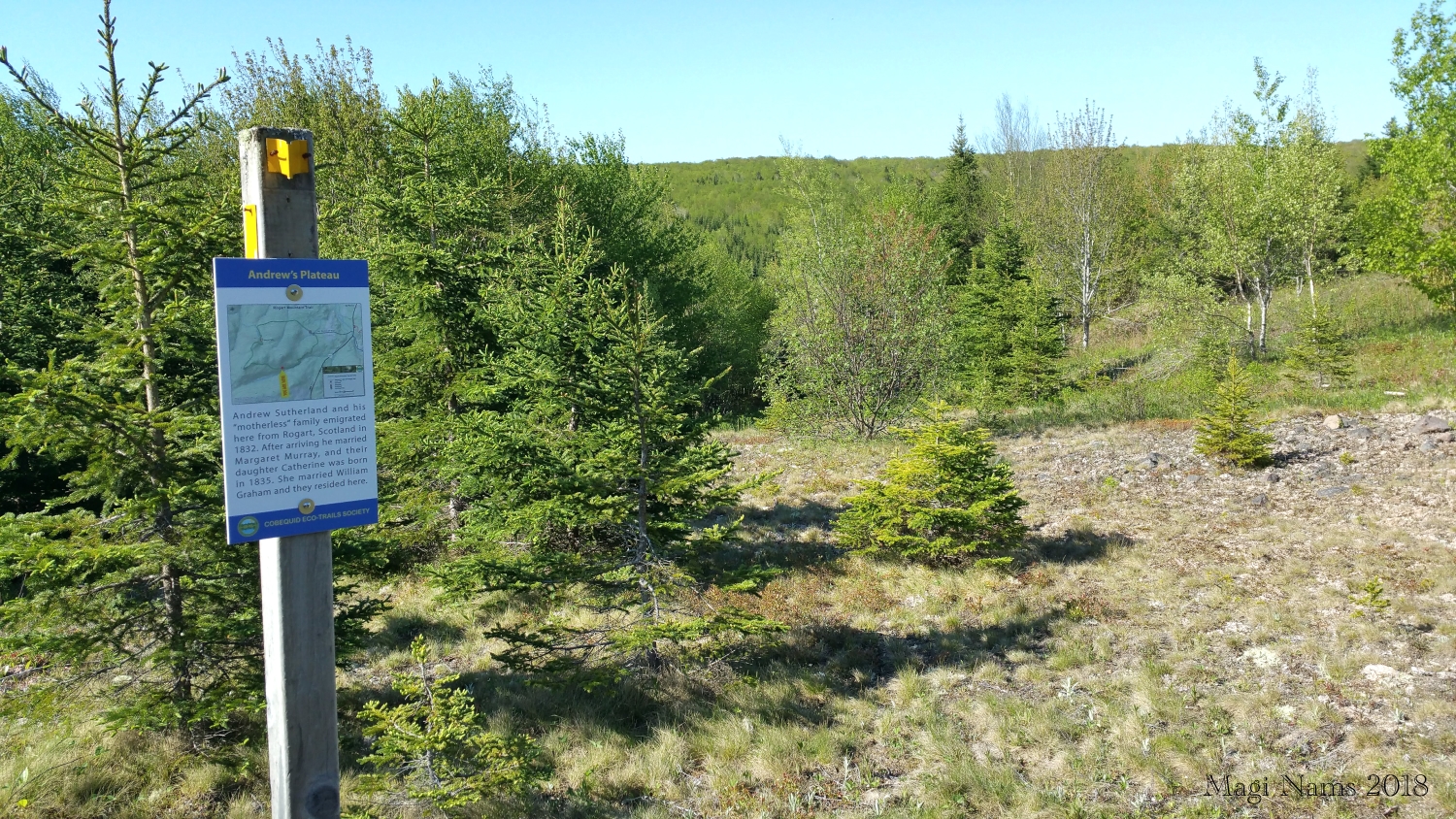
Andrew’s Plateau, Rogart Mountain (© Magi Nams)
Beyond the plateau, we continued to climb northwestward to Catherine’s Lookoff, and then traced the rim of the summit, with its stunted beeches and maples, to Rogart Mountain South Lookoff and its expansive view of the Nuttby Highlands (see opening photograph). An interpretive sign at the lookoff explained that the peak was named for Rogart, Scotland (from whence some of the settlers had come), and means “high plateau” in Gaelic. Intriguingly, it also mentioned that Canada’s first prime minister, John A. Macdonald, hailed from Rogart.
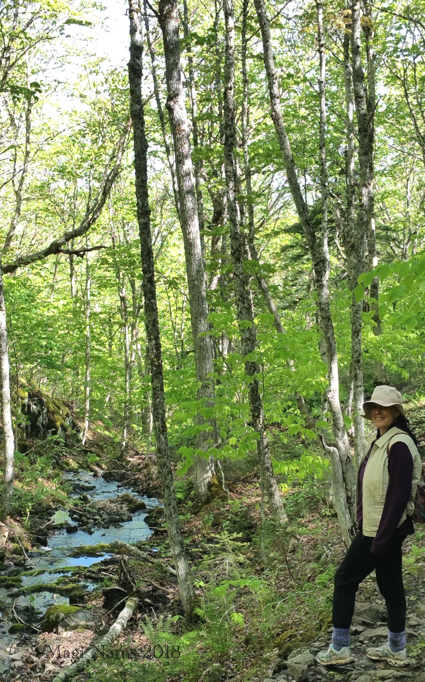
At Leattie Brook (© Magi Nams)
Past Rogart Mountain South Lookoff, the trail took a sharp turn to the northeast, leading us along the western rim of the summit and then gently downhill, and uphill to Leattie Rise. Beyond this lower hilltop, we began a steep descent into the ravine of Leattie Brook, hiking switchbacks to ease the sharp drop in elevation. Beside us, the brook spilled and babbled over moss-covered rocks, gaining in volume as we proceeded down the mountain. The highlight of this trail section is Jane’s Falls, an elegant cascade over mossy rock ledges.

Jane’s Falls, Rogart Mountain (© Magi Nams)
.
.
Past the falls, we traced the ravine northward and then swung east, hiking along the mountainside. Along with the falls, this section of trail is my favourite and well worth the rigorous climb over the peak to reach it. (The trail can also be hiked in the opposite direction, offering easier access to the falls.) Sugar maples and birches towered over us, and I heard the songs of woodland warblers high among the branches. All was green and serene—a perfect spring morning.
We left the woods and hiked the last and easiest trail section—an old road that passes the stone foundation of settlers Robert and Nancy Munro—back to the trailhead, enjoying the warm sunshine and beauty of Nova Scotia in June.

Robert and Nancy Munro Foundation, Rogart Mountain Trail (© Magi Nams)
If you’re in northern Nova Scotia and looking for a two-hour, challenging wilderness hike, Rogart Mountain is a great choice. Highly recommended!
At Leattie Brook on Rogart Mountain (© Dianne Jefferson)

Hello Magi,,,, My name is Jane Burris, we lived in Balfron on the 311 Highway until
2002 and you just helped me find my great great great grandparents Robert & Nancy Munro. In doing research I found your sight,The Seeker I am so excited, now I have to go see the foundation of their home. Thanks so much.
Jane Burris ( janeburris@icloud.com
Pictou
902-759-3273
Hi, Jane! Great to hear from you. I live near the Balmoral Grist Mill and believe we met when I had a Writers In The Schools visit in Pictou. I’m so glad you stumbled across my website and the photograph of your ancestors’ home’s foundation. I’ve hiked Rogart Mountain several times since the post you read, and I’m always impressed by the fortitude of the Scottish settlers who made their homes on that rugged terrain. Perhaps it reminded them of their homeland.
Best wishes.
Magi