Wind which this morning bore a cool bite ripened into flirting warmth by the time I walked to Bicentennial Park in late afternoon. The Ross River ran high, its banks barricading tidal inflow, its twisting path a curving avenue for airborne birds – anhinga, Caspian terns, gull-billed tern, Pacific black ducks, Australian white ibises. Dried grass in the park crunched beneath my sneakers, and the smell of smoke pervaded the air. To the north, plumes of grey rose, while in the south, wind rolled billowing smoke clouds over Mount Stuart’s eastern flank and onto the Ross River floodplain and Townsville.
Two thoughts occurred to me as to the source of the fires, the first being cane farmers burning sugarcane before harvesting it to rid it of rats, snakes, and dead growth (which some farmers still do); the second being prescribed burns. Because the smoke sources appeared closer to the city than the nearest cane fields, I dismissed the cane-burning hypothesis and settled instead for that of prescribed burns, which are planned fires lit to achieve particular purposes.
Australia has a long history of fire, with much of its dominant vegetation – in particular, woodlands dominated by Eucalyptus or grasslands dominated by resin-rich Spinifex – being adapted to surviving fires and dependent on fires for regeneration. In March, when Vilis and I drove through Marysville, that small Victorian town northeast of Melbourne so devastated by 2009’s Black Saturday fires, we saw forests of scorched eucalypts with bare, blackened branches, but which had sprouted lush new growth right through the bark of the trees. So, fire is no stranger to the Australian landscape.

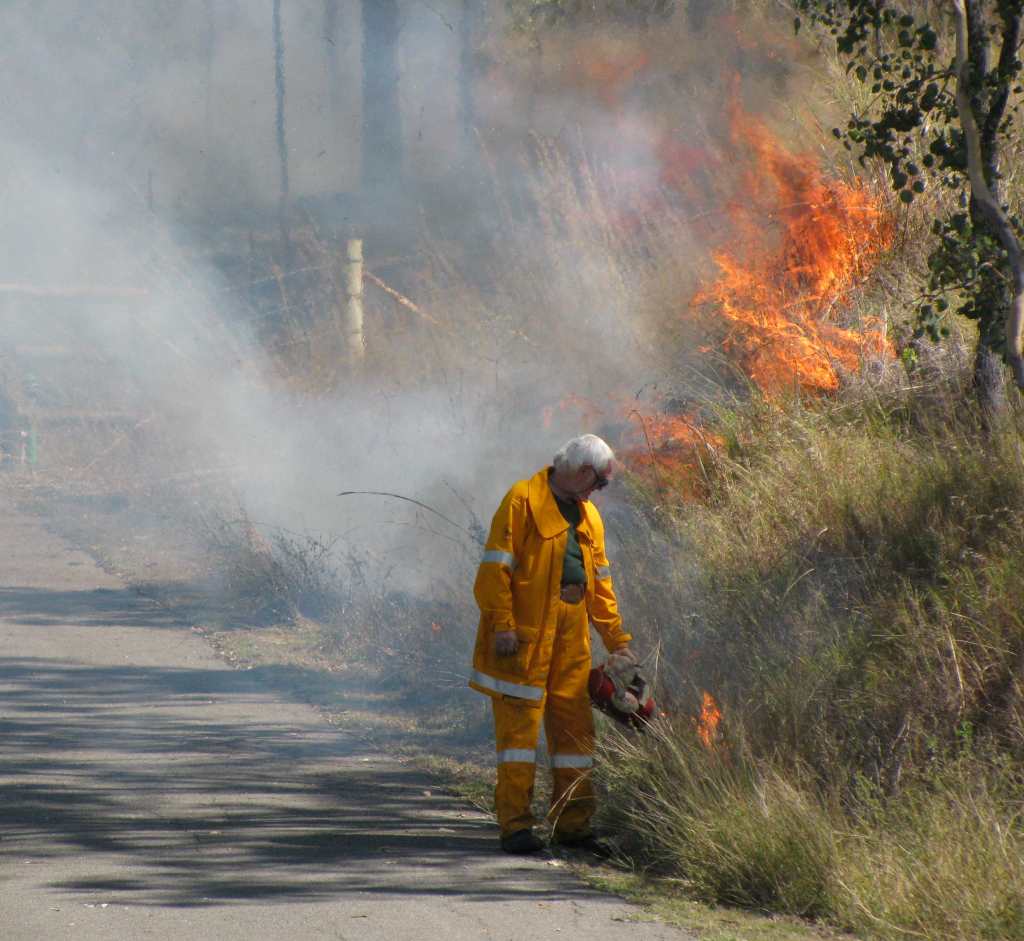
Prescribed Burn near Townsville (© Vilis Nams)
The use of fire to manage the Australian landscape also has a long history. Thousands of years ago, Aboriginal peoples began lighting fires to open up forests, hunt mammals, and renew the growth of vegetation favoured by prey species.1 Today, Australians utilize prescribed burns to renew grazing land, maintain biodiversity in native ecosystems, and especially, to reduce the amount of fuel available to bushfires that threaten human lives and assets.2 Such prescribed burns are lit in planned patterns and at carefully chosen times, taking into account topography, fuel load, and weather conditions.2 They mitigate the impact of future bushfires and also decrease the hazards of fighting them.2
On average, about 29 million hectares of land are burned by bushfires in Australia each year, but this figure may stretch or shrink by four times, depending on the year.2 In 1974-75 a total of 115 million hectares burned. That’s 15% of the country.2 It’s an interesting fact that while 90% of Australian bushfires occur north of the Tropic of Capricorn in savannah woodlands and hummocky grasslands with generally low fuel loads, the remaining 10% of fires, which typically occur in high-fuel mountain forests south of the tropic line, may burn five times as hot as the northern fires.2 The peak fire season in the tropics is during the dry season between April and November, while in the more southerly temperate zone, it’s between December and March.2 Black Saturday fell right in the middle of that southern risk period, on February 7.
Because of extreme summer climates and vast expanses of fire-adapted vegetation, many environments within Australia are threatened by severe bushfire risk.2 After last year’s Black Saturday fires, a new ‘Catastrophic’ level of 100+ on the Fire Danger Index was created. It describes environmental conditions relating to temperature, windspeed, rainfall, and fire ‘fuel’ condition that could lead to catastrophically destructive bushfires such as those experienced on Black Saturday, when the FDI reached 189 at Kilmore.3 In January of this year, Vilis and I heard news reports of catastrophic fire levels declared in the states of Victoria and South Australia. With the prospect of increased global warming on the horizon, the number of days when those warnings are issued could increase significantly.

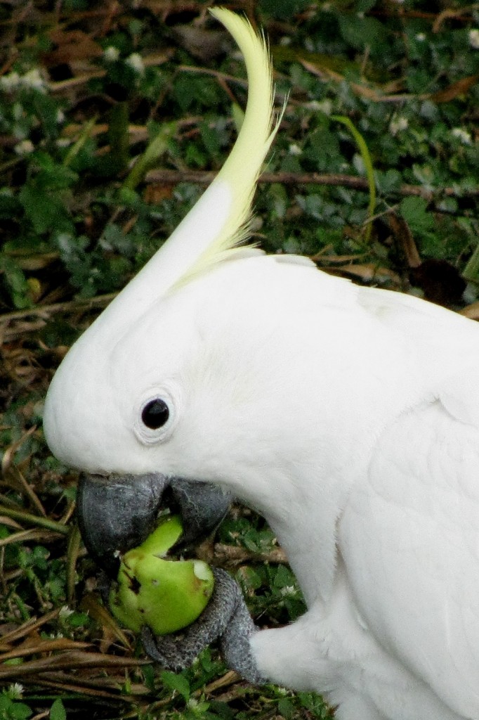
Sulphur-crested Cockatoo (© Magi Nams)
Today’s birds: peaceful doves, nutmeg mannikins, rainbow lorikeets, masked lapwings, figbird, straw-necked ibis, whistling kite, myna, sulphur-crested cockatoos, great bowerbird, welcome swallows, Australian magpie, yellow honeyeater, anhinga, brown honeyeater, rainbow bee-eaters, gull-billed tern, black kite, Caspian terns, Australian white ibises, red-backed fairy-wren (f), Pacific black ducks, magpie-lark.
References:
1. Chris Johnson. Australia’s Mammal Extinctions: A 50 000 year history. Cambridge University Press, Cambridge, p. 146.
2.. Bushfire Cooperative Research Centre and Australian Fire Authorities Council. The Use of Prescribed Fire in Bushfire Control. Fire note No. 2, April 2006. Accessed 12-Aug-2010. http://www.bushfirecrc.com/publications/downloads/Firenote_2_prescribed_burning.pdf
3. New South Wales Fire Brigade Employees Union and Greenpeace. Future risk: The increased risk of catastrophic bushfires due to climate change. 27 January 2010, pp.3-4. Accessed 12-Aug-2010. http://www.greenpeace.org/raw/content/australia/resources/reports/climate-change/future-risk-280110.pdf


